
SAVANNAH, Ga. () — Cool and breezy conditions with on and off rain continue through the rest of the weekend.
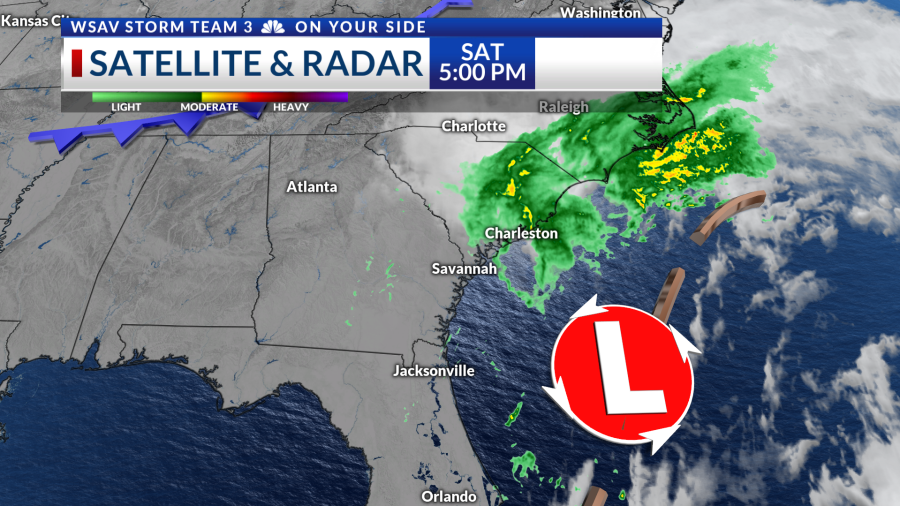
An area of low pressure situated to our east contributed to a rainy day for parts of the region. The heaviest rainfall occurred in the Coastal Empire and Lowcountry along and north of I-16, with some locations receiving over an inch of rain.
Rain chances will persist tonight through midday Sunday as moisture from the coastal low moves through the region. Expect intermittent light rain, but it won’t be a complete washout.
Sunday will feature cool temperatures and breezy conditions under mostly cloudy skies with winds coming from the northwest. By late Sunday, rain chances will diminish as dry air settles in for the upcoming week.
Monday marks the start of a series of pleasant days with partly cloudy skies and warmer temperatures in the afternoon. The rest of the week will see mornings in the 50s and 60s, with predominantly sunny skies helping temperatures climb into the upper 70s to lower 80s. A reinforcing cold front will arrive by Wednesday, keeping humidity low.


Tracking the Tropics
Tropical Storm Jerry has dissipated as per the 5 p.m. advisory from the National Hurricane Center. The system no longer maintains a closed circulation and is no longer considered a tropical system.
A tropical wave located a few hundred miles south-southwest of the Cabo Verde Islands has a 40% chance of becoming a depression or named storm. This system is expected to turn north well east of the Caribbean and poses no threat to land.
There are no tropical threats for the Coastal Empire and Lowcountry at this time.


