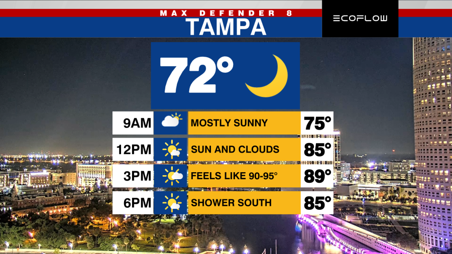

TAMPA, Fla. (WFLA) — Prepare for another day of warmth and humidity as temperatures rise into the mid to upper 80s this afternoon. When you factor in the humidity, it will feel closer to 95 degrees.

Expect a blend of sun and clouds throughout the day, with most areas remaining dry. There is only a 10% chance of isolated showers, mainly south of I-4, later in the day.
A cold front is set to move through on Wednesday. Although it won’t bring any rain, it will usher in lower humidity and slightly cooler temperatures as the week progresses.

Afternoons will continue to be warm with highs in the mid-80s, but mornings will be more comfortable with temperatures dropping to the mid-60s.

This pleasant weather pattern will persist through Saturday. However, a new system is expected to arrive by Sunday and Monday, increasing the likelihood of rain as another front passes early next week.

Meanwhile, Invest 98L is gathering strength in the central Caribbean Sea and is anticipated to develop into a tropical storm later today.

Forecast models continue to show the system slowing down and stalling in the central Caribbean over the next few days before most of the models turn it off to the northeast sometime between this weekend and early next week.

As of Tuesday morning, the threat is low for any impacts to the Tampa Bay area but something we will monitor for any changes over the next week. Significant impacts are possible for portions of the Caribbean Islands and possibly the Bahamas.