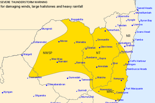

The Bureau of Meteorology has issued a severe thunderstorm warning for various parts of New South Wales, with weather conditions expected to bring damaging winds, large hailstones, and heavy rainfall.
This alert covers the Mid North Coast, Northern Tablelands, and sections of the Northern Rivers, North West Slopes and Plains, as well as the Central West Slopes and Plains forecast districts.
Heavy downpours could result in flash flooding in the warned areas over the coming hours, with potential impacts on locations such as Coffs Harbour, Port Macquarie, Armidale, Moree, Tenterfield, and Narrabri.

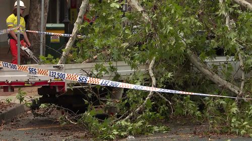
Residents of Tamworth likened the winds to a mini tornado, as the forceful gusts uprooted trees and caused roofing to become entangled in power lines.
In the Hunter region, Muswellbrook experienced gusts reaching speeds of up to 100 km/h.
Furthermore, Tamworth Airport recorded wind speeds as high as 124 km/h.
The Bureau of Meteorology has said that a warm and humid airmass mixed with a trough and west to south-westerly change has resulted in the thunderstorm warnings for this afternoon and evening.
Locals are being urged to stay vigilant and monitor conditions.