

ORLANDO, Fla. – Social media is buzzing with weather models suggesting snowflakes might grace Central Florida. But how likely is this wintry event?
Let’s delve into the details.
First, for snow to occur, a key requirement is cold air. Central Florida has that covered.
The next essential factor? Moisture in the atmosphere.
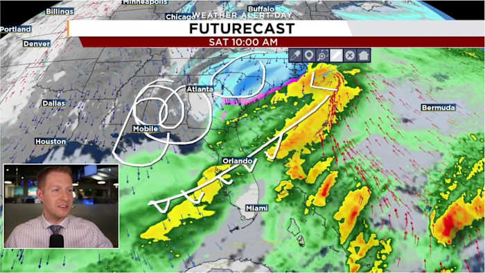
A powerful cold front is set to sweep across Central Florida, ushering in the region’s chilliest temperatures in years.
While rain is expected as this front moves in, the temperatures will still be too high to transform raindrops into snowflakes.
By the time it gets cold enough for snow in Central Florida, the moisture will mostly be gone.
Historically, when flakes or mixed precipitation has been observed in Central Florida, an area of low pressure develops off the Atlantic coast of Florida.
That developing system sends moisture back into the freshly-injected cold air, creating the wintry precipitation.
That’s not what’s happening here.
A couple of models briefly depicted Gulf-effect flakes, cold air going over the relatively warm waters of the Gulf. This is the same mechanism that produces lake-effect snow along the Great Lakes.
The Canadian model is the only numerical model currently suggesting flakes near the Gulf coast of Florida.
The European model had a few flakes closer to Tampa but has since dropped any signal.
For snowflakes to make it this far inland from the Gulf, the wind would almost have to be due west.
If that were the case, warmer air would also start pushing in, lowering that chance further.
Could it happen? Yes. It is it likely? Absolutely not.
Copyright 2026 by WKMG ClickOrlando – All rights reserved.


