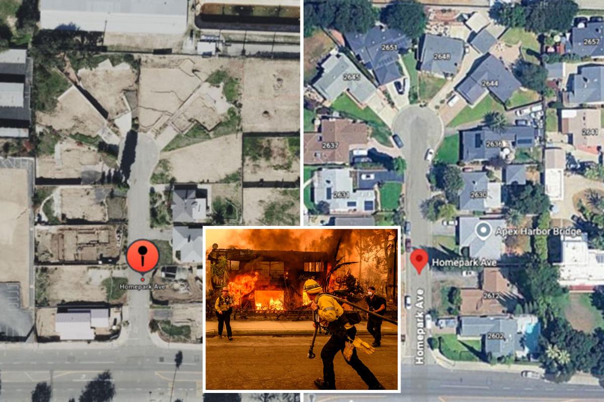


Google Maps users have recently noticed a curious alteration in the satellite imagery of areas previously devastated by last year’s Palisades and Eaton wildfires. These images, which once depicted the widespread destruction left by the fires, now appear to have reverted to pre-fire visuals, leaving many puzzled.
This unexpected change has sparked speculation about potential political motives behind the decision, although no concrete evidence has emerged to support such theories. In an effort to verify the reports, The California Post conducted its own investigation and confirmed that several regions previously scarred by the flames are now depicted as untouched on the platform.
Notable examples include Homepark Avenue in Altadena, which was severely damaged, yet now appears unscathed on Google Maps. Similarly, Iliff Street and Radcliffe Avenue in the Pacific Palisades, both of which suffered extensive fire damage, are shown in their pre-fire state.
While some users report that they can still access the post-fire imagery on their devices, many others have observed this apparent rollback and are actively seeking Google’s attention to address the issue. The inconsistency has left people confused and concerned, particularly those relying on accurate maps for critical decisions.
One such individual, Chris J, shared his frustration on a Google Maps forum. On May 14, he posted about his efforts to assess potential homes to buy or rent in the Palisades area. Up until April 2026, Chris could view the fire-damaged landscapes on Google Maps, but he noted that the imagery changed a few weeks ago, complicating his decision-making process.
Chris J posted on a Google Maps forum on May 14 that he was trying to make a decision on what homes to buy or rent in the Palisades. Until April 2026, he said he was able to view post-fire conditions on Google Maps, but that changed a few weeks ago.
“People need the correct and accurate information to make informed decisions about the area,” Chris said. “I don’t know why Google would have accurate information for 16 months and then CHANGE it to old, outdated, incorrect information.”
Another user noted there could be technical reasons why such an inexplicable change was made.
That has not stopped quite a few locals from having suspicions of a more political nature.
“Apparently Google decided ‘showing current reality’ might not be ideal for reelection optics of LA mayor?” wrote Edward Mehr, CEO of Machina Labs, who shared previous and current map images of his burned neighborhood near Sunset Boulevard.
The comment is in reference to Democratic Los Angeles Mayor Karen Bass, who is defending her seat this year from Democratic City Councilmember Nithya Raman and Spencer Pratt, who is running as an independent but is a registered Republican. Bass previously was accused of softening up a post-fire report by the city.
Pratt, whose own home was burned down in the Palisades Fire, reacted with genuine confusion and a hint of anger. His home burning helped spark his run for mayor, alleging Bass and city leadership failed him.
“Dear Google, wtf is this,” he responded on social media.
National political influencers have also picked up the chatter. Libs of TikTok blatantly declared the change as “election interference.”
More tech-minded folks offered some more technical excuses as possibilities for the change. On a forum on Y Combinator, the prestigious Silicon Valley startup accelerator, one user surmised that “the simplest explanation is that they lost access to the recent imagery” due to licensing issues.
Another noted the fact that in other parts of the world, Google Maps still shows five-years-old satellite images, such as in Budapest.
A Google spokesperson referred The Post to a statement it issued on social media Monday in response to the speculation by the public, calling the pre-fire viewings “a technical issue triggered by a recent, routine update to satellite imagery in Google Maps and Earth.” That update restored old imagery, the company said, and it is working to fix the glitch “ASAP.”