
ORLANDO, Fla. – Central Florida is shifting back into a typical summer weather setup this week, with scattered afternoon storms returning and temperatures heating up again through the middle of the week.
MONDAY & TUESDAY
Scattered showers and thunderstorms are forecast to form Monday afternoon into the evening, with rain chances near 50% to 60%. Coverage is expected to dip a bit Tuesday, with storm chances closer to 30% to 40%.
On Tuesday, storms could get an earlier start than usual in northern parts of Central Florida before spreading southward later in the day and into the evening.
Some storms may briefly become strong, bringing wind gusts between 40 and 50 mph, frequent lightning, small hail and pockets of heavy rain. Localized rainfall totals of 1 to 3 inches will be possible.
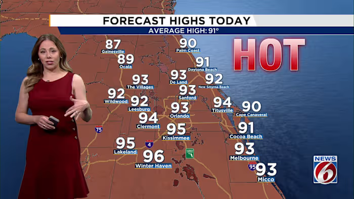
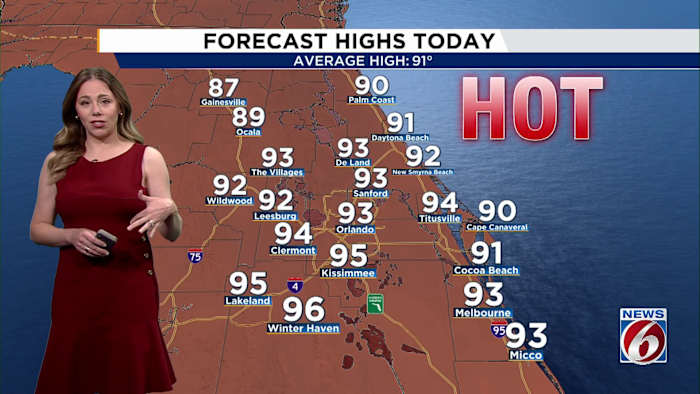
Afternoon highs Monday will rise into the low and mid-90s, while humidity will make it feel even hotter. Heat index values are expected to peak between 102 and 107 degrees during the warmest part of the day.
MIDWEEK
A plume of Saharan dust will continue moving into Florida through midweek, limiting some storm activity while giving the sky a hazy appearance. The dust could also enhance sunrise and sunset colors, but it may lead to periods of moderate air quality, especially for people who are sensitive to pollution.
As rain chances decrease Wednesday and Thursday, temperatures are expected to climb back into the mid-90s across much of Central Florida.
Combined with the humidity, heat index values will once again push into the 102 to 107 degree range during the afternoon, bringing another round of widespread moderate to major heat impacts before a more typical summertime storm pattern returns heading into next weekend.


