
Internewscast
  • Home
  • US News
  • Local News
  • World
  • Health
  • Business
  • Politics
  • Crime
  • Entertainment
  • Videos
  • Guest Post
  • Support Our Cause
Internewscast
  • Home
  • US News
  • Local News
  • World
  • Health
  • Business
  • Politics
  • Crime
  • Entertainment
  • Videos
  • Guest Post
  • Support Our Cause
Home Local news Brace for Intense Storms and Gusty Winds Ahead of Central Florida’s Upcoming Cold Snap
  • Local news

Brace for Intense Storms and Gusty Winds Ahead of Central Florida’s Upcoming Cold Snap

  • 3 minute read
Total
0
Shares
Share 0
Tweet 0
Pin it 0
Possible strong storms, gusty winds in the Central Florida forecast before our big cold plunge

Up next

Shots fired at Border Patrol agents in Chicago: DHS

DHS Reports Gunfire Targeting Border Patrol Agents in Chicago

Published on 09 November 2025

Author

Internewscast

Share article

The post has been shared by 0 people.
Facebook 0
X (Twitter) 0
Pinterest 0
Mail 0


Brace for Intense Storms and Gusty Winds Ahead of Central Florida's Upcoming Cold Snap

ORLANDO, Fla. – Florida experienced a warm day today, with temperatures reaching the upper 80s in many areas. As we look ahead to Sunday, expect similar heat but with a chance of storms.

The SPC has us tagged for an isolated threat for severe weather, primarily in the form of damaging winds. The possibility of some small hail in our more organized thunderstorms can’t be ruled out all thanks to the rapid chill that’s going to be coming in from up north. (Copyright WKMG 2025)

The Storm Prediction Center has issued a level one, marginal risk alert for severe thunderstorms across the entire region. The primary concerns are strong straight-line winds, with a lesser chance of small hail.

The storm system has started digging south tonight, headed our way for tomorrow and early Monday morning (Copyright WKMG 2025)

Showers are expected to develop on Florida’s western coast early in the morning, continuing until around noon. At that point, atmospheric conditions will become more conducive to storm formation.

During the middle afternoon and through the evening rains and storms will stick with us ahead of the cold front. The front itself should flush the environment out overnight into Monday morning. (Copyright WKMG 2025)

The early part of the day may see isolated heavy downpours, gusty winds, and lightning. However, the more significant weather activity is anticipated to begin later in the afternoon, around 4 to 5 p.m.

Forecasters are tracking a weak atmospheric disturbance expected to move across the peninsula during the midday hours. This will likely increase the number of areas experiencing rain and storms throughout the day.

Here’s a look at what to expect tomorrow into very early Monday morning. The main threats we’re watching out for will be damaging winds and small hail (Copyright WKMG 2025)

As a result, some regions may continue to see rain into the late evening, extending into the start of the new week.

The actual cold front isn’t set to come through us until very early Monday morning, sometime between midnight and 2 a.m.

As it does so, winds will quickly shift towards a northerly direction funneling in the dense layer of cold, dry air we’ve been awaiting and discussing the last few days leading up to this event.

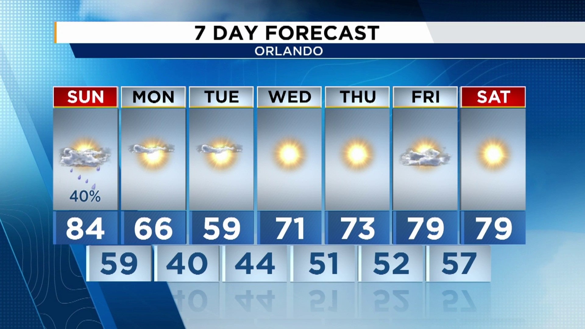
Traditionally we see a little bit of a lag with such a shallow and thick mass of chilly air, so the coldest temperatures won’t settle in with us until we wake up Tuesday morning. But, your afternoon highs on Monday will have to fight to try and reach the 70s.

Layer up as you head out Tuesday morning, especially for our northern counties! The winds behind this cold front will be pretty harsh, driving feels like temps potentially WELL below freezing (Copyright WKMG 2025)

Then we’ve actually nudged our afternoon high temp for Tuesday even chillier as computer models are anticipating a lot of us to hardly reach 60 degrees during the “relatively warmest” part of the day.

For my fans of the cold weather, however, I’ve got some bad news. If you came down to Central Florida to escape the cold temps, this would be great news for you!

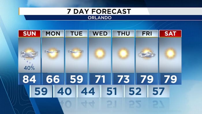
This abrupt plunge of frigid temperatures for Florida’s standard will be fairly short-duration. If you look at the seven day forecast, we bounce back incredibly quickly into the 70s by Wednesday and towards next weekend.

The mid-sections of November look a night and day difference compared to what we’re tracking by Monday and Tuesday (Copyright WKMG 2025)

I would highly encourage you grab some extra zinc, iron, and vitamin C now while you can in preps for this roller coaster ride. This way your immune system is geared up for these wild swings. Usually when the weather hits you with this type of whiplash, it’s an internal struggle to keep up with the changing conditions.

So definitely consider staying active while you can the next several days, keep your hydration high even though it’ll be far from warm or even hot outside, and get those vitamins supplemented to stay healthy while we ride this short burst out.

The mid-sections of the month are expected to be about average around here, if not even above average as we close in on the Thanksgiving holiday and Black Friday extravaganza’s.

Daily Forecast

The News 6 Weather team ensures you’re always on top of the day’s weather.

Copyright 2025 by WKMG ClickOrlando – All rights reserved.

You May Also Like

A small-town Alaska fisherman has Republicans on the defensive as they try to keep US House majority
  • Local news

Small-Town Alaska Fisherman Puts Republicans on Defense in House Fight

JUNEAU, Alaska – As Alaska’s primary election season intensified this summer, independent…
  • Internewscast
  • October 10, 2026
Park service could remove more than 500 trees at historic golf course Trump wants to redesign
  • Local news

Park Service May Remove 500 Trees for Trump’s Historic Course Redesign

WASHINGTON – The National Park Service has launched another round of tree…
  • Internewscast
  • October 10, 2026
Medvedev advances at Shanghai in his first match since his China Open disqualification
  • Local news

Daniil Medvedev Wins First Match Since China Open Disqualification at Shanghai Masters

SHANGHAI – Daniil Medvedev returned to action with a victory Saturday, winning…
  • Internewscast
  • October 10, 2026
Baby thrown from NYC balcony clings to life as vigil held for slain Bronx mom
  • US

Baby Thrown From NYC Balcony Fights for Life as Bronx Mom Is Mourned

The 8-month-old baby who plunged from a 15th-floor Bronx balcony in her…
  • Internewscast
  • October 11, 2026
Up to 5,000 children to have social media blocked for six weeks
  • News

Up to 5,000 Children Face Six-Week Social Media Block

Thousands of children are taking part in a six-week trial examining whether…
  • Internewscast
  • October 11, 2026
Tropical storm Rachel forces iconic California beach to close down
  • News

Tropical Storm Rachel Forces Closure of Iconic California Beach

Tropical Storm Rachel has prompted the closure of an iconic California beach…
  • Internewscast
  • October 11, 2026
Parents 'confined' their child in playpen for 20 hours: Cops
  • Crime

Parents Accused of Confining Child in Playpen for 20 Hours, Police Say

From top to bottom: Sara Tudor and Michael Brown, according to the…
  • Internewscast
  • October 11, 2026

Internewscast Journal

  • Home
  • Privacy Policy
  • DMCA Notice
  • Terms and Conditions
  • Guest Post
  • Support Our Cause
Copyright 2026. All Right Reserverd.