
Share this @internewscast.com
ORLANDO, Fla. – As the weekend approaches, the tropics are showing increased activity with a tropical wave near the southern Bahamas, potentially moving closer to Florida by Monday.
Since the exact track and intensity forecast remains a bit uncertain, this is a system Floridians need to keep close tabs on through the weekend.
Invest 94L, no matter its precise trajectory and intensity, may affect our coastal waters by Saturday, causing rough surf, turbulent seas, beach erosion, and a heightened risk of rip currents.
THURSDAY & FRIDAY
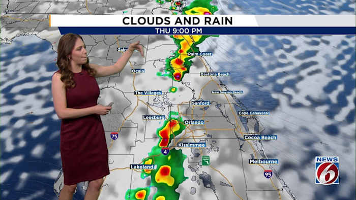
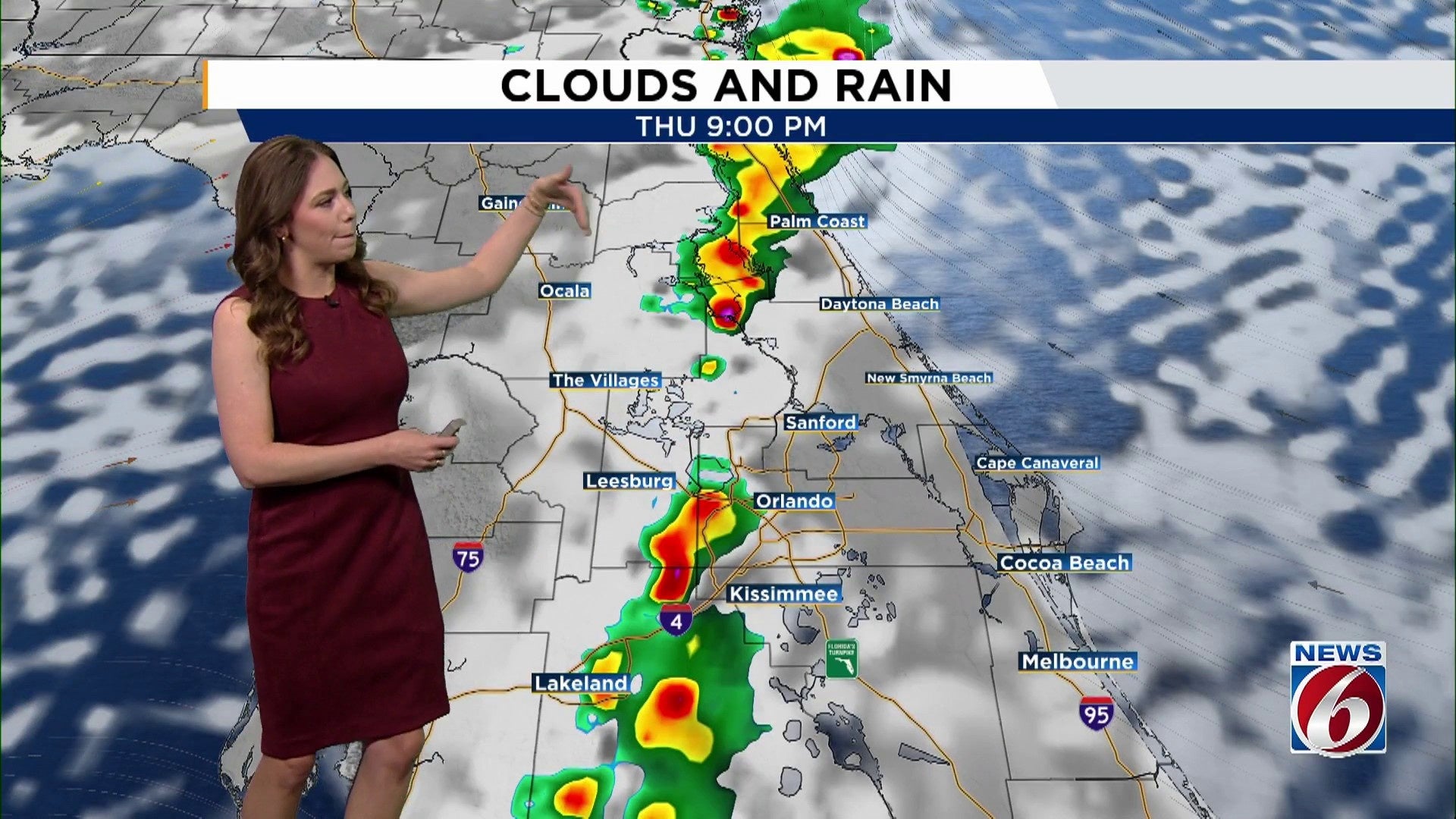
Scattered showers and some storms are expected to begin later, starting in the early evening and continuing overnight. The sea breezes may converge, triggering isolated intense storms as many head to sleep on Thursday night, resulting in lightning, gusty winds up to 40–50 mph, small hail, and heavy rain in short bursts. The probability of rain is around 50-60%.
The delayed onset of cooling storms will allow temperatures to rise to the upper 80s and lower 90s, with heat index values reaching 100–105 degrees each afternoon.
WEEKEND-EARLY NEXT WEEK
Invest 94L, a tropical disturbance near Puerto Rico and the Dominican Republic, may come close enough to bring impacts to Florida’s coast.
Although most models currently suggest it will remain just off Florida’s east coast, forecast accuracy is expected to improve in the next few days as it evolves over the Bahamas.
As of Thursday morning, expect higher rain chances Saturday (50–70%) and continued scattered storms through early next week.
[VIDEO BELOW: Candace Campos tracks the tropics]
Copyright 2025 by WKMG ClickOrlando – All rights reserved.