
Share this @internewscast.com
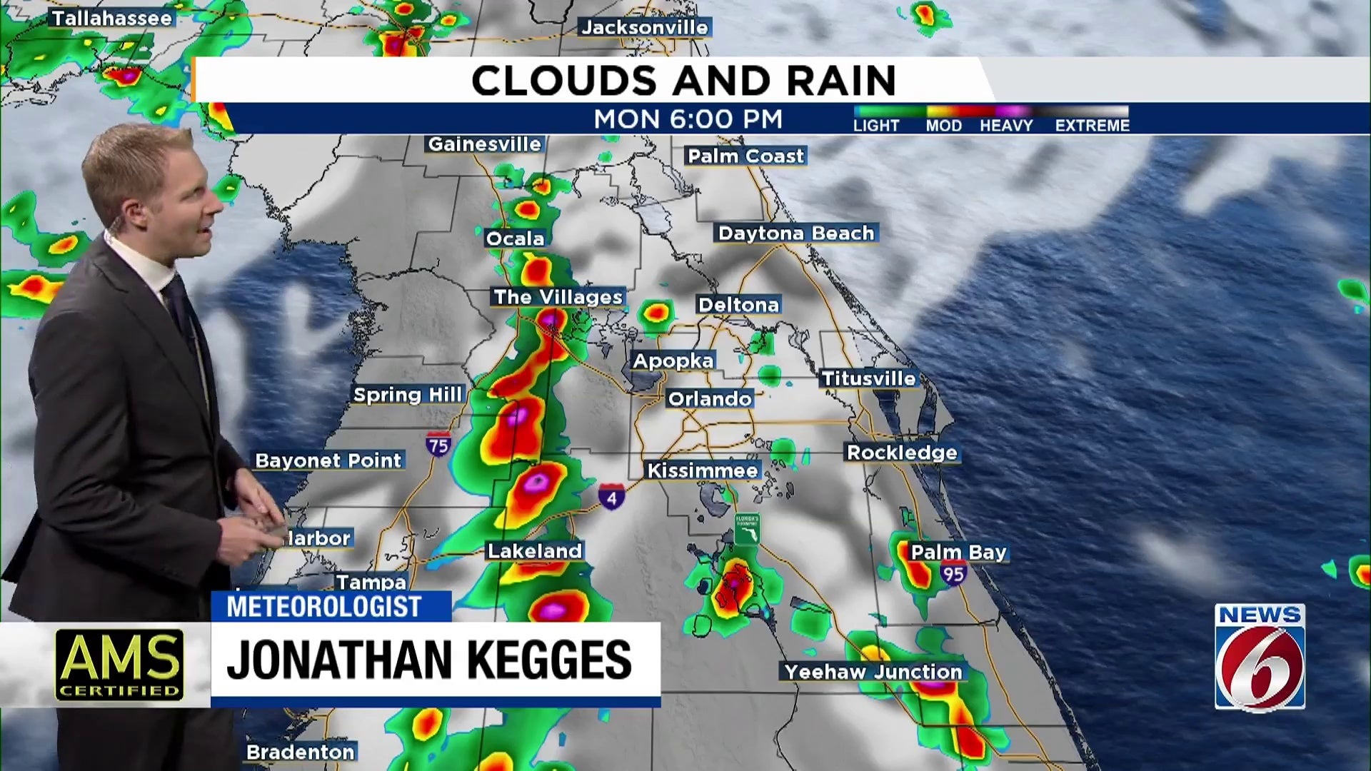
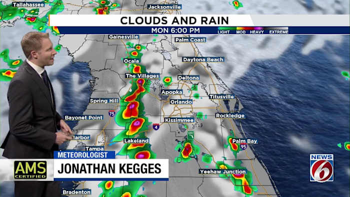
ORLANDO, Fla. – The weather was calm for people traveling to work and students going to school, but scattered storms are set to make a comeback Monday afternoon in Central Florida.
The highest storm chances will focus west of Orlando and especially along the I-75 corridor.
High temperatures will be in the low to mid-90s.
Expect relatively lower storm chances through the middle of the work week.
With the lower storm chances also comes higher heat.
Highs will climb into the mid- to upper 90s Tuesday and Wednesday. The heat index will approach 110 degrees.
Tropics
Invest 97L, the disturbance near the Cabo Verde islands, has a high chance for tropical development over the next 48 hours.
This disturbance will likely become the first hurricane of the 2025 hurricane season as it moves west-northwestward through the Central Atlantic.
Meanwhile, development chances continue to drop for Invest 96L in the subtropical Atlantic.
Copyright 2025 by WKMG ClickOrlando – All rights reserved.