
Share this @internewscast.com
Orlando, Fla. – The latest drought monitor report for our state is now available, and the scenario is promising thanks to the substantial rainfalls we’ve experienced in Central Florida.
Expect heavier showers as we approach the weekend. The easterly winds are funneling in moisture, coupled with a newly-formed tropical disturbance off the eastern coast trying to organize itself.
Although the chances for that system to develop appear uncertain at this moment, it will still contribute additional moisture to our local weather, soaking us with rain from Friday through Sunday.
Sunday does seem to clear us out, or at least begin to push all this nastiness toward the north away from our area.
If you checked my article yesterday discussing October’s outlook for us Floridians, the analysis indicates that we might face a generally wet month. This could interfere with some fall and Halloween plans, but it won’t be a total washout.
There will be dry spells mixed in, but overall, our rainfall may exceed the usual average levels.
What happens after October? Especially once we get into winter. Does the rain stick around?
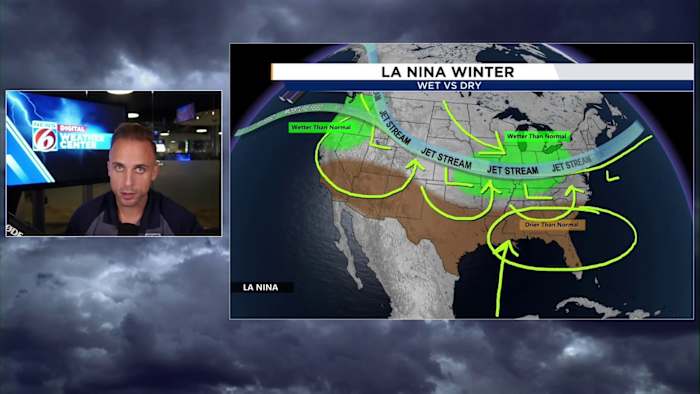
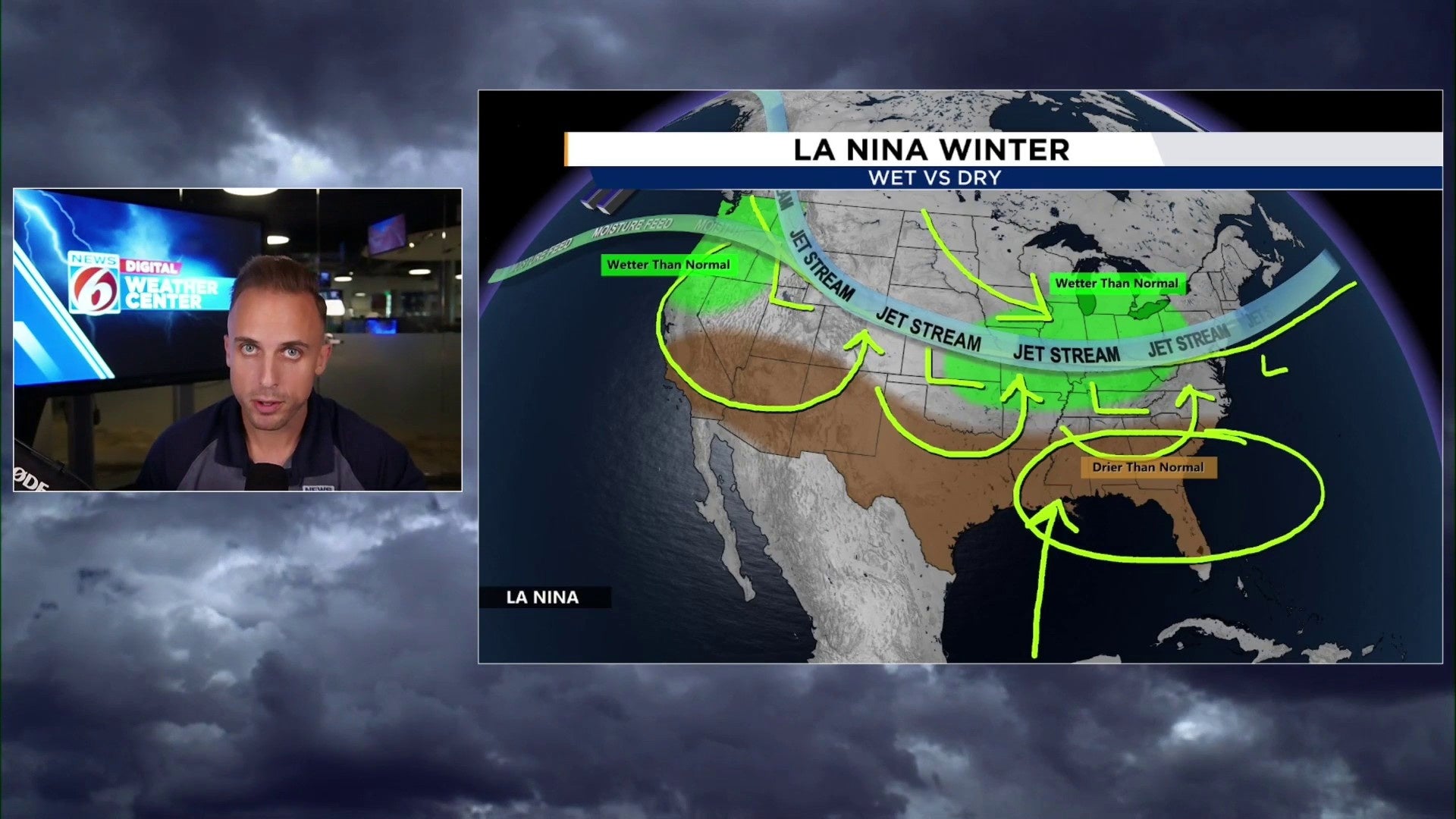
This scenario is tricky to predict due to the evolving La Niña conditions in the tropical Pacific. It seems likely that dry periods and more arid weather will return to our state during the winter.
So we’ll have to hold on to our water as best we can, especially once we get into the Christmas season and the New Year ahead.
Climate models and seasonal dynamical models show evidence we’ll be back in weak La Niña conditions from about late this month through to the likes of February or March. This means another predominantly dry winter.
That could lead us right back into a drought over Central Florida, as we get away from the wet season and see less storm systems make it this far south.
It all has to do with the jet stream flow that occurs west to east over the northern United States. During La Niña, this usually keeps the flow well away from Florida and the rest of the southeast.
Winter storms tend to follow the flow of the jet as their life source for developing and strengthening. When the cold fronts attached to the southern half of these rotating low pressure centers sweep across our state, we can usually see some bands of light to heavy rain.
But then that’s it!
Whereas during El Niño conditions in the Pacific, we get these punchier storm systems to come down across the Gulf coast and over our area. This is when we really see an increase in our rainfall totals for the winter and spring months.
So while October could be a bit on the rainier and milder side, we’ll start to really see rain chances back off between November and December into the new 2026 year ahead of us.
Copyright 2025 by WKMG ClickOrlando – All rights reserved.