
ORLANDO, Fla. – Central Florida is in for another steamy, moisture-filled day, with largely dry conditions early on before afternoon thunderstorms begin to pop up.
STORM CHANCES
The day will start with mostly sunny to partly cloudy skies, but cloud cover is expected to increase later as scattered storms form along the sea breeze.
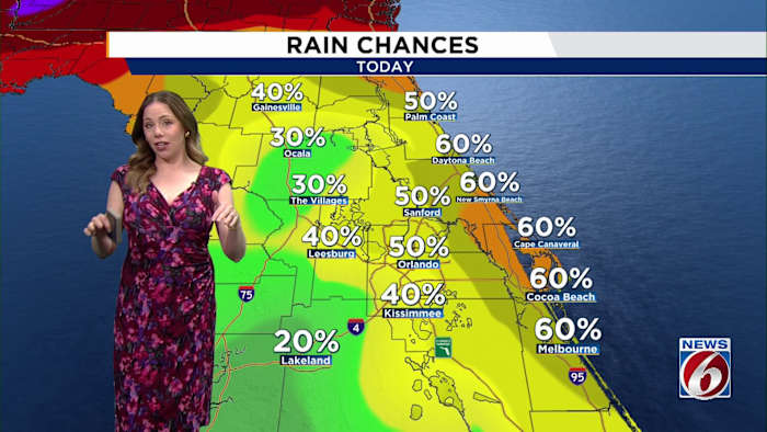
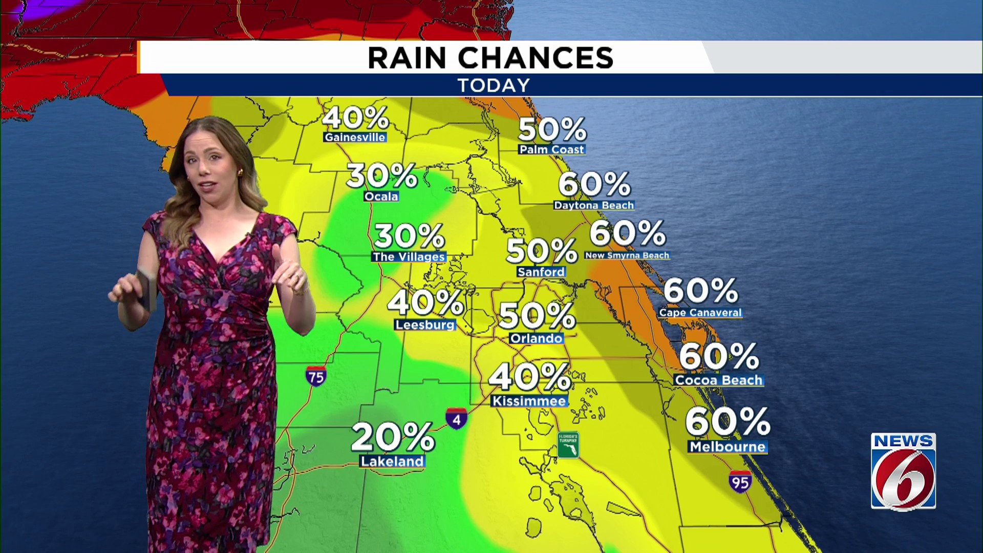
Coastal areas are likely to see the best chance for rain today, with storm coverage projected between 40% and 70%.
A few of those storms may turn strong, bringing frequent lightning, wind gusts of up to 50 mph, and intense downpours that could quickly produce 1 to 2 inches of rainfall.
By Wednesday, rain chances are expected to ease a bit, with the sea breeze remaining nearer the coastline and storm coverage falling to around 30% to 40%.
TEMPERATURE TREND
Even with the chance for storms, heat remains the bigger story.
Afternoon temperatures will climb into the mid 90s, while heat index values are expected to reach 102 to 107 degrees. A Moderate to Major Heat Risk remains in place across East Central Florida, with an Extreme Heat Risk in portions of Brevard County today and expanding into parts of Brevard, southwest Orange, and northwest Osceola counties on Wednesday.
LATE WEEK
Storm chances increase again later this week as deeper tropical moisture returns to the region. Scattered afternoon and evening storms are expected Thursday and Friday, with the potential for stronger storms and heavy rainfall continuing into the weekend.
Temperatures will remain well above normal through early next week, with afternoon highs in the low to mid 90s and warm overnight lows in the 70s