

ORLANDO, Fla. – Fourth Forecast
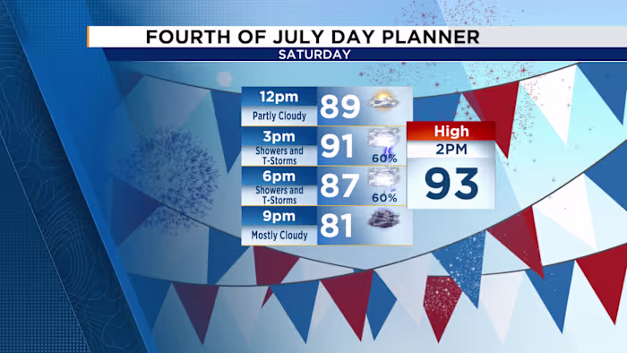
A deeper supply of moisture will continue moving into the atmosphere Saturday, setting the stage for a noticeable increase in storm coverage across the area. The morning should remain dry with a mix of sunshine and clouds, helping temperatures climb into the lower 90s by early afternoon. Heat index values are expected to reach 100-105ºF.
Showers and thunderstorms are likely to begin developing around 1 p.m., with more widespread activity spreading from southwest to northeast over Central Florida by mid-afternoon. If you have barbecue plans, lunchtime will be the better window to get outside before storms build in. The good news is that the activity should weaken fairly quickly as early evening approaches.
By 8 p.m., mostly dry weather should take over, setting up an extremely humid but largely rain-free fireworks display around 9 p.m.
Sunday
Moisture will remain in place for Sunday, though it will not be quite as widespread as Saturday. That will still support another round of afternoon storms developing along the sea breeze, just with slightly lower coverage. Afternoon highs will stay in the lower 90s, while heat index values again climb above 100ºF.