
Share this @internewscast.com
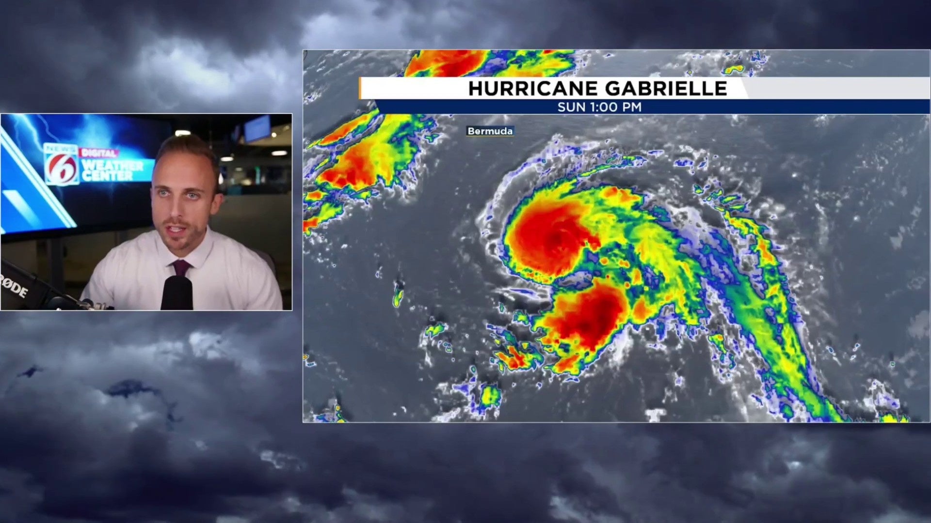
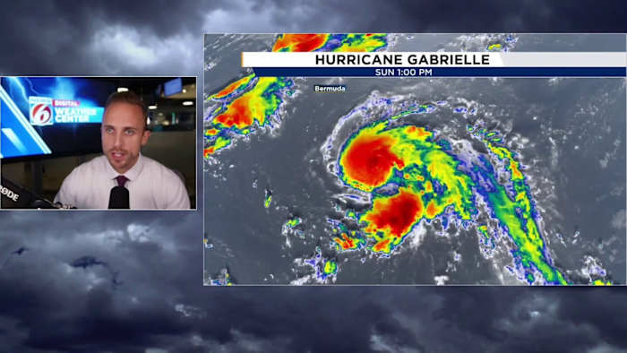
Orlando FL – By 5 p.m., reconnaissance aircraft detected wind speeds within Gabrielle exceeding 74 mph, prompting the National Hurricane Center to elevate its status to a hurricane.
Central pressure continues to drop steadily, meaning the storm continues to strengthen as it heads mostly northward in the central Atlantic.
Currently, the hurricane exhibits sustained winds of 75 mph, with core pressure having decreased by about three millibars since the last update 3-6 hours prior. As the pressure declines, the winds adjust, albeit with a slight delay.
One breaking detail as well; Gabrielle is now forecast to see a brief window of becoming a major hurricane blowing past 111 mph by Tuesday.
During its journey across the tropics, Gabrielle has persisted admirably, now steering northward and increasing in latitude as it moves into the central Subtropical Atlantic.
Initially forming as a disorganized and expansive low-pressure area, it has navigated into a conducive part of the basin, allowing for steady intensification to commence.
The storm’s satellite imagery has improved significantly compared to the previous week, with a well-defined center continuing to develop.
Fortunately, Central Florida is again spared from significant impact. In fact, the entire U.S. can expect to avoid notable effects from this second hurricane of the season. Bermuda is also likely to sidestep major impacts, with the system projected to remain well east of the island.
Being east of Bermuda, it puts our friends out there on the weaker side of the hurricane.
One thing I want to immediately note is despite how quiet and unusually slow this season has been, especially the peak, according to tropical history, we’re nearly right on schedule for our second hurricane of the season which typically comes together into late September.
Behind Gabrielle, September is trying to come alive with not one but now two additional tagged areas of interest by the Hurricane Center. One was previously highlighted last week, but NHC dropped it given chances of development lowered significantly inside that seven day window.
Both are still hit or miss with our global computer models, but especially the tropical wave given a 50% chance of formation within the next week does seem to have the potential of grabbing our next name on the list – Humberto.
All in all, Gabrielle should give us some additional credit for this slow boil of a hurricane season while staying away from major land masses. The Azores of the northeast Atlantic will have to watch the progression of Gabrielle as it hooks hard right headed towards them down the pike as a high end tropical storm or maybe even dissipating hurricane.
Copyright 2025 by WKMG ClickOrlando – All rights reserved.