Share this @internewscast.com

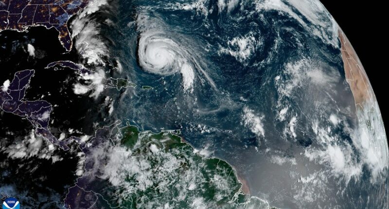
In Tampa, Florida (WFLA), the National Hurricane Center announced that Hurricane Humberto, a robust Category 4 storm, accelerated overnight on Saturday and is progressing northwest at nearly 13 mph.
The hurricane is anticipated to veer back to the north by Sunday morning, before swinging sharply to the northeast, aiming for open Atlantic waters by Monday evening. As of early Sunday, at 5 a.m., Humberto is situated about 585 miles south of Bermuda.
While Humberto isn’t projected to make landfall, it’s expected to cause swells and turbulent seas affecting parts of the Caribbean islands, along with Bermuda and the Southeast United States.
Humberto has maximum sustained winds of 155 mph, bordering the threshold for a Category 5 hurricane, which starts at 157 mph or more. The NHC forecasts that Humberto will maintain its powerful hurricane status in the coming days.
Florida’s Atlantic Coast should brace for possible tropical storm conditions beginning Monday, as Tropical Depression Nine is predicted to move northward past the area. The NHC indicates that it’s likely to intensify as it moves through the Bahamas, bringing heavy rains and strong winds.
Tropical Depression Nine is expected to grow into a tropical storm by the end of Sunday. With current wind speeds at 35 mph, it needs further intensification to achieve tropical storm classification, which requires sustained winds of at least 39 mph.
TD Nine will be approaching Georgia and the Carolinas early next week, and is expected to strengthen into a hurricane by Tuesday. If it does reach hurricane status, it will be named Hurricane Imelda. The North Carolina governor declared a state of emergency ahead of the storm’s arrival to “mobilize resources and prepare for potential impacts.”
Watch Tracking the Tropics on Tuesdays at 12:30 p.m. ET/11:30 a.m. CT
or listen on Spotify or Apple Podcasts. Be prepared with the 2025 Hurricane Guide and stay ahead of tropical development with the Tracking the Tropics newsletter.


