
ORLANDO, Fla. – As we enter the heart of hurricane season, attention is turning to a potential weather system that could stir in the Gulf of Mexico by mid-June. This developing situation is being closely monitored as it holds the potential to affect the region’s weather patterns.
THE CURRENT OUTLOOK
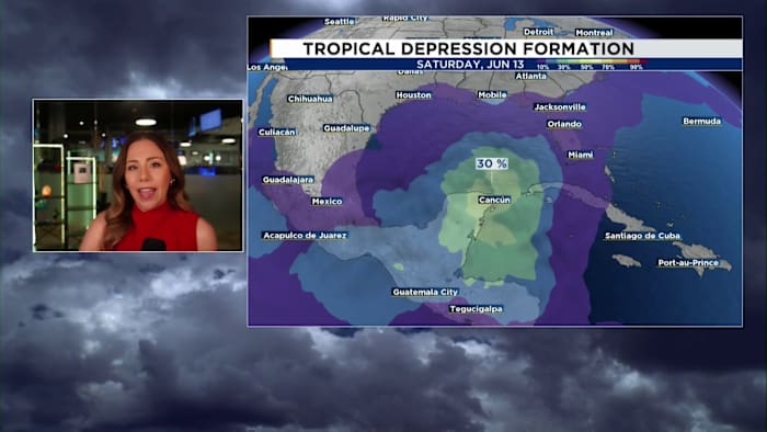
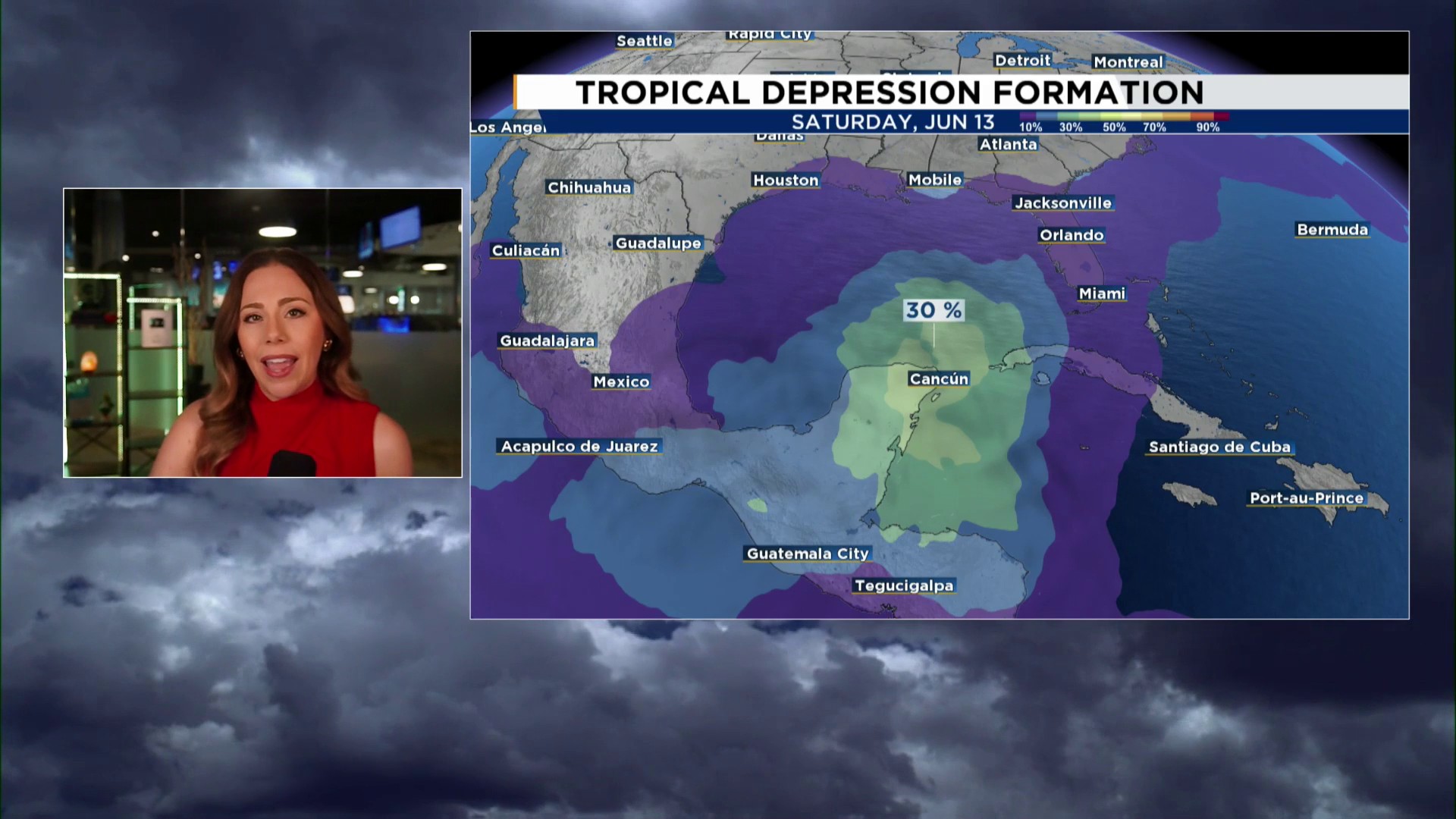
The Atlantic Ocean is relatively calm at the moment, but there are signs that this tranquility could be short-lived. Several tropical models are indicating the possibility of a tropical low forming near the western Caribbean and the southern Gulf as we approach mid-June.
This anticipated development is linked to a typical June weather phenomenon known as the Central American Gyre. This expansive region of low pressure often acts as a catalyst for early-season tropical activity in the Caribbean. While the gyre can sometimes give rise to tropical lows, these systems generally tend to be weak and lack organization.
POTENTIAL FOR TROPICAL ACTIVITY
As we look ahead, forecast models are predicting a rise in tropical moisture and increased storm activity near the Yucatán Peninsula and the southern Gulf around the second weekend of June. While it’s too early to predict the exact impact, residents and officials in the region should stay informed and prepared as the situation unfolds.
If anything were to develop, the most likely outcome right now would be a tropical depression as chances for a named tropical storm appear less likely.
Regardless of whether development occurs, this setup could eventually bring an increase in tropical moisture and rainfall to parts of the Gulf Coast, including Florida.
TAKEAWAYS
This is something to watch, not something to worry about. Remember, watching the tropics is part of the process, and it does not automatically mean a threat is developing.
The News 6 Weather Team will continue tracking the latest trends and will keep you updated as we get a better handle on the forecast in the days ahead.