
Share this @internewscast.com

ORLANDO, Fla. – A flash flood warning is in effect for northwestern Brevard County until 1 p.m. Tuesday.
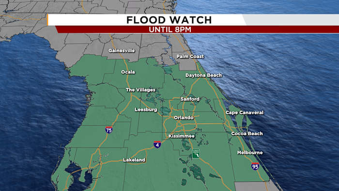
East Central Florida is experiencing a flood watch that extends until 8 p.m. on Tuesday, due to escalating concerns about localized flooding, with rainfall rates climbing to 3-4 inches per hour.
In the recent days, the area has been drenched by several series of tropical downpours, causing rainfall amounts to reach between 5 to 7 inches in specific locations, notably in southern Brevard and northern Volusia County. On Tuesday, increased rainfall rates in Central Brevard County continue to raise worries about potential localized flooding.
This has already triggered multiple advisories, and more rain is expected through the evening.
The flood watch impacts a broad region, including both coastal and inland areas of Volusia, Brevard (covering inland, mainland, and barrier islands), as well as northern and southern Lake, Orange, Osceola, and Seminole counties.
With the ground saturated, any additional rainfall could lead to flooding of rivers, creeks, streams, and urban areas with poor drainage. Smaller waterways could rise out of their banks, and flash flooding in low-lying areas is a possibility.
This ongoing rainfall and flood risk are being driven by a broad area of low pressure in the eastern Gulf of Mexico, known as Invest 93L.
While this system remains disorganized, it’s continuing to feed moisture into Florida and could develop further as it moves into the central Gulf later this week.
Copyright 2025 by WKMG ClickOrlando – All rights reserved.