Share this @internewscast.com
ORLANDO, Fla. – Prepare for a wet and stormy holiday weekend in Central Florida, as conditions will include daily storms, significant rain, and potential flooding.
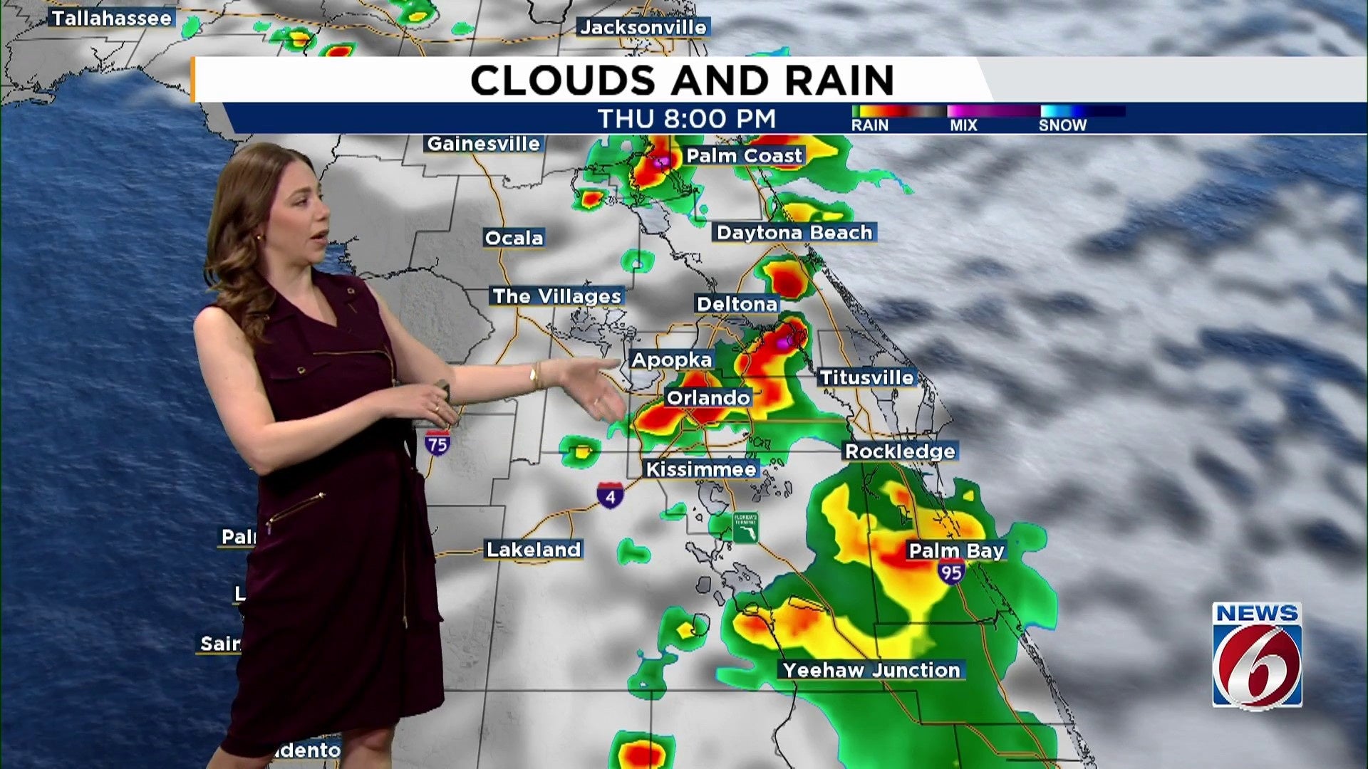
THURSDAY
Early Thursday will see isolated showers forming near the coast and moving inland with the afternoon and evening sea breeze. Rain coverage will return to standard levels between 50-60%.
These storms will be sporadic but may bring heavy rain. Expect frequent lightning, gusty winds reaching up to 50 mph, and brief downpours potentially delivering 1-3 inches of rain quickly. Some stronger storms might result in small hail.
By Thursday evening, activity will drift back toward the coast and should move offshore by midnight.
FRIDAY-WEEKEND
The combination of deep tropical moisture and a stationary front will lead to repeated afternoon and evening showers and storms. Rain and storm probabilities increase to 70-80% across the region, with heavy rain, lightning, and gusty winds each day.
As areas become saturated and storms recur over the same spots, the risk of localized flooding rises, particularly by the weekend. Most of the area is already under a Marginal Risk for excessive rainfall.
Some spots could see 2–4 inches of rain through the weekend, especially in areas that get multiple rounds of storms.
[VIDEO BELOW: Apopka residents seek solutions for rising lake levels]
Neighborhoods near the St. Johns River, including Astor, should stay on alert as levels will be on the rise.
While the weekend will NOT be a washout, when it rains it could rain hard and fast.
With a busy holiday weekend ahead, stay weather-aware, especially if you’ll be outdoors. When thunder roars, go indoors!
NEXT WEEK
The unsettled pattern holds through at least Tuesday, with rain chances staying high (70–80%).
The front slowly drifts south by midweek, which may help bring slightly drier air by Wednesday or Thursday.
Copyright 2025 by WKMG ClickOrlando – All rights reserved.