

Areas east of I-4 will see most of the storms this afternoon.
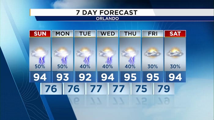
ORLANDO, Fla. — Sunday morning is expected to stay dry across Central Florida, with a blend of sunshine and clouds. Combined with a light west-southwest breeze, conditions will help temperatures rise back into the mid-90s, while heat index values are forecast to reach roughly 100 to 105 degrees.
Showers and thunderstorms are expected to begin developing around 2 p.m. As a stronger westerly steering flow takes hold, those storms should track back toward the east coast through the latter half of the afternoon and into the early evening.
Heat will continue building through the upcoming workweek as a ridge of high pressure strengthens in the middle and upper levels of the atmosphere over Florida. That pattern will promote sinking, warming air across Central Florida, leading to two main impacts: fewer rain chances and higher temperatures.
By the end of the week and into next weekend, highs could climb into the mid to upper 90s, with heat index readings remaining well above 100 degrees.