
SAVANNAH, Ga. () — Tuesday afternoon was hot and breezy. High temperatures warmed into the upper 80s to lower 90s.
A few isolated showers and storms were able to develop for some inland areas.
Conditions were also breezy at times due to already being under the influence of Hurricane Erin’s circulation.

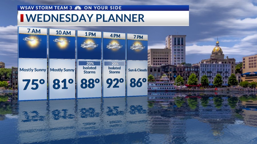
The weather pattern from Tuesday will persist into Wednesday and Thursday, with both days featuring partly sunny and hot conditions, accompanied by a few isolated showers and storms.
Highs will again make it to the upper 80s to lower 90s.
A strong breeze may occur, particularly on Wednesday along the coastline, with wind gusts occasionally exceeding 20-25 mph. This offshore wind has already led to rough surf and a high risk for rip currents.


The upcoming high tide cycles could result in minor coastal flooding over the next few days. The high tide on Wednesday evening is projected to reach 9.5 feet, the minor flood stage for Fort Pulaski.
These concerns at the coast will continue through the week as Hurricane Erin travels northward along the East coast.

Rain and storm chances will be back starting on Friday once Hurricane Erin begins to pull away from the U.S.
A frontal boundary moving southward will help to initiate scattered showers and storms Friday afternoon and into the weekend.
Afternoon temperatures are expected to trend below average due to increased cloud cover and scattered showers, with weekend highs only reaching the mid-80s.


TRACKING THE TROPICS
Hurricane Erin experienced weakening on Tuesday, sustaining winds of 105 mph as of 8 p.m., with even stronger gusts. The hurricane has been contending with dry air.


Not much has changed with the forecast path and should stay about 450 miles off of our coast.
For Georgia and South Carolina, the main concerns are high surf and rip currents, with breezy and gusty conditions along the coast on Wednesday.

The NHC is also watching two other tropical waves in the Atlantic for potential development into tropical depressions or tropical storms.
A tropical wave located over the central Atlantic has a medium (60%) chance of development over the next 5-7 days.
This one is now looking to lock in on a path similar to what Erin took, keeping it away from the Caribbean islands and the U.S.
Though it is still worth monitoring this system for changes over the next week or so.

A second tropical wave is located southwest of the Cape Verde Islands. This one has been developing some thunderstorms around a broad area of low pressure.
Chances for development into a depression or storm are low (30%) right now.
However, the environment will become more supportive for development as it moves westward. Current projections keep this system further south than Erin and the central Atlantic tropical wave.
It may become an issue for the Caribbean over the weekend or next week.


