
SAVANNAH, Ga. () — The hot and humid conditions that we have been experiencing through the week continued for Friday afternoon.
Heat index vales at times spiked to about 110°F for several locations. Actual highs topped out in the mid to upper 90s.
Several powerful storms emerged in the evening, resulting in breezy and gusty winds paired with extremely heavy rainfall, leading to flooding concerns in Effingham and inland Bryan County.
A LOOK AHEAD
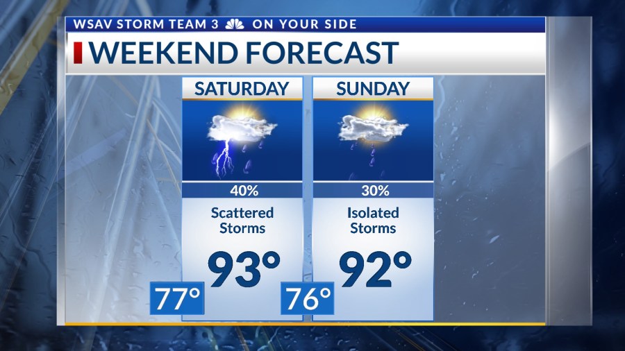
More rain and thunderstorms are expected over the weekend. The bulk of rain and storms will be on Saturday.

Temperatures will still make it into the mid 90s for most locations which will provide plenty of energy to fuel storms.
Some storms may be strong with gusty wind and frequent lightning. Heavy rain may lead to localized flooding concerns.


Heat index values will be over 105°F before scattered storms develop. Heat alerts may be issued again by the National Weather Service.
Although there is a chance of more storms on Sunday, a drier trend is expected to establish itself. Temperatures on Sunday are anticipated to rise to the low to mid-90s. This drier trend is likely to persist through the early part of the following week.
A disturbance will swing though the southeast late in the week and it will help to increase storm chances for Thursday and Friday.
TRACKING THE TROPICS
Tropical storm Erin strengthened into a hurricane with the 11 a.m. advisory from the National Hurricane Center.
As of 11 p.m., Hurricane Erin is maintaining sustained winds of 100 mph, with gusts reaching up to 120 mph, classifying it as a Category 2 hurricane. The storm is visibly intensifying, with a well-defined eye forming, as seen in recent satellite imagery.

Erin is predicted to strengthen further in the days ahead. It is anticipated to reach major hurricane status, Category 3 or higher, by Saturday. Current intensity forecasts suggest Erin could escalate to a Category 4 hurricane, with sustained winds reaching around 145 mph by Sunday.

The storm’s anticipated course remains consistent with previous expectations, expected to veer north before nearing the Bahamas later this weekend.
Erin is projected to pass approximately 500 miles away from the Georgia and South Carolina shores. The primary effects anticipated for much of the U.S. east coast are dangerously high surf and an increased risk of rip currents. No other direct impacts are expected at present.