
Share this @internewscast.com
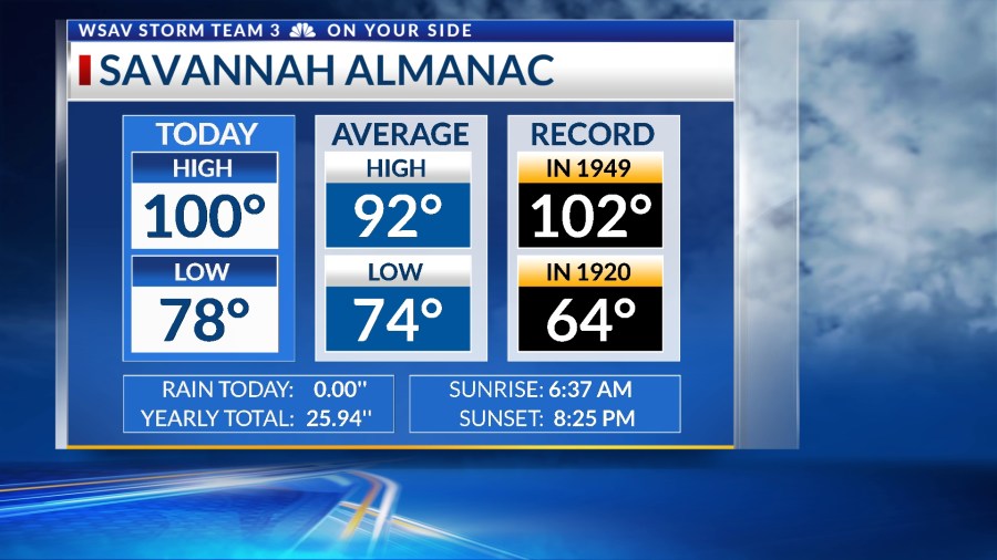
Monday was the warmest day of the year in Savannah, reaching a scorching 100°F with a maximum heat index of 112°F. This marks the first occasion Savannah has hit 100°F since June 23, 2022.
Several places further inland experienced even higher temperatures, with Baxley reaching 104°F and a peak heat index of 114°F. The weather outlook predicts continued heat for the rest of the week, accompanied by chances of showers and thunderstorms.


A LOOK AHEAD
Tuesday is expected to be another sweltering and muggy day. Afternoon temperatures are anticipated to rise to the mid to upper 90s, with some inland areas possibly hitting 100°F again. High humidity will cause the heat index to range between 105 – 115°F at times.
Heat advisories are already in place for Tuesday. Conditions will begin to cool off by the late afternoon as scattered showers and storms gradually become more widespread.

A few storms may be strong due to the heat providing ample fuel, but organized severe weather is not expected at this time.
Rain and storm chances will be a little lower for Tuesday through Friday. Temperatures will remain in the mid to upper 90s. Heat index values will be over 105°F at times each day.


A frontal boundary is forecast to settle in over the southeast by the weekend. This cold front will help to bring in elevated rain and storm chances over the weekend.
Temperatures will be close to normal to actually below normal Saturday, Sunday, and Monday with highs in the upper 80s to lower 90s.

HEAT SAFETY
Be sure stay cool and hydrated while taking plenty of breaks in a cool place. It is also recommended to limit outdoor activity to the early morning hours and to the evening to avoid the peak heating hours.
Remember, it becomes harder for your body to cool off as the heat index rises because your body needs evaporating sweat to cool down. It becomes harder for evaporation to happen with extremely high humidity.

TRACKING THE TROPICS
All is quiet across the Atlantic basin with no development expected over the next 5-7 days as of Monday evening.
Water temperatures in the main development regions are running close to normal if not slightly below normal, especially in the Caribbean Sea.