
Share this @internewscast.com
SAVANNAH, Ga. () — Wednesday certainly was pretty nice and comfortable. Afternoon highs were again in the mid and upper 80s for most locations.
A few communities in the southwestern part of the area were able to reach the lower 90s.
The influx of dry air from the North has kept the heat index, or “feels like” temperatures, closely aligned with the actual temperatures.
LOOKING AHEAD
Starting Thursday and Friday, moisture will gradually return to the area as an onshore flow develops. This shift could result in a few scattered showers on both days.
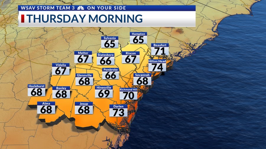
Afternoon highs both days will top out in the mid to upper 80s. Morning lows will be in the mid to upper 60s.

For the Labor Day weekend, rain chances are predicted to increase due to an incoming system from the west. Heavy rain is a possibility from Saturday to Labor Day Monday.
Despite the heightened rain prospects, extensive flooding like last Friday and Saturday is not anticipated. Total rainfall over the three days is estimated to reach around 1-2 inches in much of the region, but localized areas could receive more.


Afternoon highs over the weekend will top out in just the upper 70s to lower 80s for most locations.
Next week will continue to feature below-normal afternoon highs with slightly lower rain chances.
Long-range guidance indicates that below-normal temperatures are also expected as we look beyond the seven-day forecast into early September.


TRACKING THE TROPICS
Meanwhile, the National Hurricane Center continues to track Tropical Storm Fernand in the North Atlantic Ocean. As of 5 p.m. EDT, Fernand exhibits sustained winds of 50 mph, with gusts reaching up to 65 mph.
Fernand is approximately 650 miles south of Newfoundland, Canada, and is projected to shift into a post-tropical low in the coming days.
There is no threat to the U.S. or any land at this time.


Elsewhere in the tropics, no further development is expected within the next five-seven days. There are a few tropical waves located in the intertropical convergence zone now, but all are weak and disorganized.
None of the global forecast models are picking up on any development within the next week to week and a half.
This is all good news for the Atlantic basin as we approach the statistical peak of hurricane activity on September 10.