Share this @internewscast.com
SAVANNAH, Ga. () — Thursday afternoon ended up being a pretty decent day weatherwise in the Coastal Empire and Lowcountry.
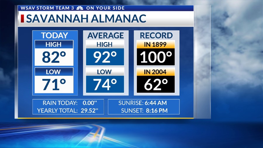
The skies were mostly cloudy, which kept the daytime temperatures cooler, ranging from the low to mid-70s. Showers and thunderstorms did not form as the air was drier than initially anticipated in the area.
However, the pattern will become more unsettled again for Friday and the weekend with more showers and storms.


A LOOK AHEAD
On Friday, there are expected to be higher chances for rain and storms, as a stronger sea breeze is likely to develop. Rain showers and thunderstorms will start along the coast in the early afternoon and then progress inland later in the day, continuing into the evening.
Temperatures on Friday will warm into the mid to upper 80s.


A trough in the mid and upper levels is predicted to move through the southeast over the weekend, increasing the likelihood of rain and thunderstorms for both Saturday and Sunday. Heavy rainfall is anticipated, which could potentially cause localized flooding.

Due to the ongoing heavy rain and flooding from earlier in the week, the ground is still soaked. Highs will be cooler than usual, staying in the mid-80s.
As we head into next week, the rain is expected to taper off. A drier weather pattern will prevail, allowing temperatures to rise back into the lower 90s, with some areas possibly reaching the mid-90s later in the week.

TRACKING THE TROPICS
This week, the National Hurricane Center has been monitoring several systems in the Atlantic. Among these, Tropical Storm Dexter has developed in the north Atlantic.
It transitioned into a post-tropical system Thursday afternoon. It has dissipated as of Thursday evening and the NHC is no longer issuing forecast updates for that system.
Two other systems are being monitored for potential development over the next 5-7 days.
The weaker of the two is located just off of the North Carolina coast. It has a low (20%) chance of becoming a tropical depression or tropical storm.
It is moving away from the U.S. and poses no threat to land at this time.

The second system is a strong tropical wave located over the central Atlantic Ocean as of Thursday evening. It has a medium chance (60%) of becoming a tropical storm over the next 5-7 days.
It is expected to move into an environment that may support some tropical development. The environment will have warmer surface water and weaker wind shear. Any further organization will be gradual. This system is forecast to move northwest and the turning north over the coming days.
This system poses no threat to the U.S. or any other landmass at this time.