
Share this @internewscast.com
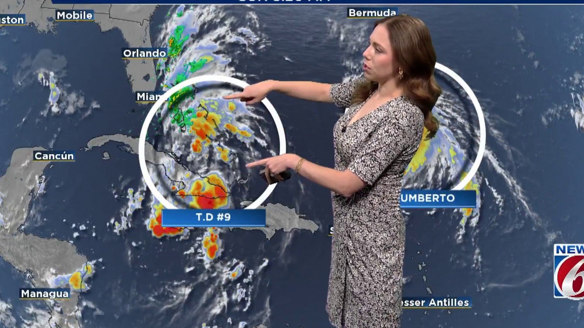
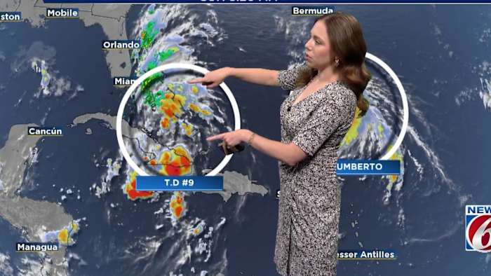
ORLANDO, Fla. – Tropical Depression Nine is gaining strength over the Bahamas and is anticipated to evolve into a tropical storm by Sunday as it moves parallel to Florida’s east coast through Monday.
A Tropical Storm Watch is active for coastal regions of east-central Florida. Rapid deterioration in conditions is expected this evening and will persist into the week’s beginning.
Rain Forecast:
As the system becomes more structured, rain chances will increase on Sunday, with scattered showers and storms arriving from the Bahamas. The heaviest rainfall is projected for tonight into Monday, especially along the immediate coast, where rainfall amounts could reach 1 to 3 inches, with isolated areas potentially seeing up to 5 inches, causing minor flooding in places with poor drainage.
Rain chances will temporarily decrease midweek due to incoming dry air, but by the weekend, moisture will return, enhancing the likelihood of more scattered showers and storms.
Marine Hazards:
Sunday night will mark the start of dangerous beach and marine conditions, worsening throughout the week. Persistent northeasterly winds paired with long-period swells will create hazardous rip currents, high surf, and increasing risk of beach erosion.
As the system moves away on Tuesday, wind speeds will gradually diminish, but dangerous beach and boating conditions will persist. Offshore swells reaching up to 12 feet will continue to generate high surf, strong rip currents, and coastal erosion throughout the week.
Wind Forecast
Winds will steadily increase Sunday afternoon, becoming breezy inland and gusty along the coast. Inland areas can expect sustained winds around 15–20 mph, while coastal gusts may reach 30 mph or higher in storm bands.
Conditions will peak Monday as the storm makes its closest approach. There is a 30–40% chance of tropical storm-force winds along the coast, with gusts up to 45 mph possible. Inland gusts will be lower, but still noticeable.
Timeline Recap:
-
Sunday: Rain bands increase, winds pick up, beach hazards begin.
-
Sunday Night–Monday: Storm makes closest pass; expect heavy rain, strong winds, and dangerous surf.
-
Tuesday–Wednesday: Winds ease slightly; surf stays rough, brief drop in rain chances.
Impacts:
-
Tropical storm-force winds possible Monday along the coast
-
1–3″ of rain through Monday. Higher isolated amounts.
-
Dangerous marine and surf conditions all week
-
Coastal flooding and erosion concerns through multiple high tides
Copyright 2025 by WKMG ClickOrlando – All rights reserved.