Share this @internewscast.com
ORLANDO, Fla. – The peak of hurricane season is here and right on cue, the Atlantic basin is staying active.
Hurricane Gabrielle is gaining strength near Bermuda, with two additional tropical waves being observed for possible development in the upcoming days.
Hurricane Gabrielle
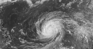
Hurricane Gabrielle remains a strong Category 1 hurricane in the central Atlantic, located several hundred miles southeast of Bermuda.
Satellite images show strong thunderstorms wrapping around the center of the hurricane, with signs that it could be potentially strengthening.
Current satellite intensity assessments indicate Gabrielle’s winds reaching approximately 90 mph, and it is anticipated to escalate into a major hurricane (Category 3 or higher) by Monday evening. The hurricane is presently moving north-northwest but is expected to shift more northerly toward the cooler North Atlantic.
No direct impacts are predicted for Florida or the U.S. East Coast; however, long-swells from Gabrielle will maintain a high risk of rip currents along the eastern coast beaches.
Other Areas to Watch
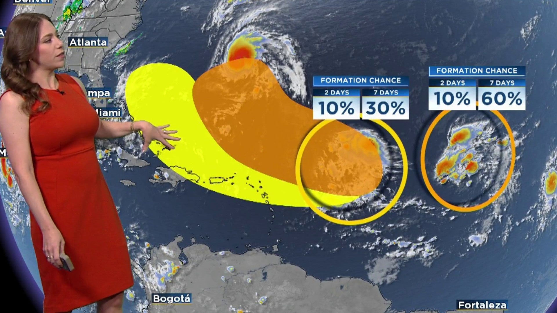
1. Central Tropical Atlantic
A tropical wave in the central Atlantic currently generates limited showers and storms due to lingering dry air. Yet, as the system progresses west-northwest, conditions are expected to become more conducive for development from mid-week onward.
-
Chance of development over the next 2 days: Low (10%)
-
Chance of development over the next 7 days: Medium (60%)
Should this system continue to develop, it might transform into a tropical depression by late week, although it remains far out over open water without posing an immediate threat to land.
2. East of the Windward Islands
A different tropical wave, situated well east of the Lesser Antilles, is causing disorganized showers and thunderstorms. This system is rapidly moving west-northwest, and despite current unfavorable conditions, there is potential for gradual development later in the week as it approaches the Caribbean.
Regardless of development, gusty winds and rainfall are expected to affect parts of the Leeward Islands late tonight into Tuesday.
-
Chance of development over the next 2 days: Low (10%)
-
Chance of development over the next 7 days: Low (30%)
Copyright 2025 by WKMG ClickOrlando – All rights reserved.