
Share this @internewscast.com

An earthquake with a magnitude of 8.8 struck off the Pacific Coast of Russia, leading to an ocean-wide tsunami and putting areas of the U.S. on alert from July 29 to July 30.
This earthquake happened early morning Wednesday, Kamchatka time, and was located about 75 miles southeast of the Kamchatka Peninsula, a long stretch of land in Russia bordering the Pacific Ocean.
This quake measured as one of the top ten strongest earthquakes ever recorded.
This region, known as the Ring of Fire, is prone to seismic activities like earthquakes and volcanic eruptions due to the collision of tectonic plates. The interaction of the Pacific Plate with various continents results in frequent seismic events.
The earthquake occurred at the boundary between the far-western edge of the North American Plate and the Pacific Plate.
In this area near Russia, the Pacific Plate is being subducted under the North American Plate, causing significant geological activity.
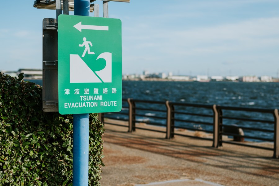
The earthquake resulted from a sudden and forceful movement, leading to enough water displacement to generate a tsunami. A tsunami is a massive wave, often triggered by earthquakes or landslides involving islands or volcanoes.
These tsunamis consist of several waves that can carry vast amounts of water over thousands of miles. They can travel at astonishing speeds of up to 500 miles per hour, moving away from the earthquake’s epicenter.
Unlike traditional ocean waves generated by wind on the water, a tsunami extends from the ocean floor all the way to the surface, generating massive amounts of power with each passing wave. As the waves reach the edge of the continental shelf, they slow down and gain height as they get closer to shore.
The first warning signs of an incoming tsunami are the water receding in dramatic fashion near the shoreline. Then, the waves arrive, and the water pushes rapidly inland due to how much energy the waves carry.
Even if the waves are not particularly high, the danger posed by powerful currents at the waterfront are problematic for anyone near the water.
For the Coastal Empire and Lowcountry, a tsunami threat is very limited. The Atlantic Ocean does not feature the magnitude of earthquake and tsunami activity that the Pacific Ocean’s Ring of Fire does.
A complex intersection of tectonic plates in the Central and Eastern Caribbean is our closest area of seismic activity. Tsunami activity rarely comes of it.
The most likely scenarios of seismic activity resulting in tsunamis come from areas southwest of Portugal in Europe, or west and northwest of North Africa.
Researchers Wronna, M., Baptista, M. A., and Miranda, J. M. that did a reanalysis of the 1761 transatlantic tsunami said an earthquake in this region sent tsunami waves across the Atlantic Ocean. Waves one to two feet in height made it to the Caribbean Islands and portions of North America.
There is one scenario where a large wave could possibly reach the East Coast of the United States that geologists have debated for years. Some argue that if a volcanic island off the coast of Africa collasped, it could result in a devastating tsunami,.
Some have theorized waves could be over twenty feet tall, across the entire Atlantic Ocean, reaching the Southeast Coast, but others disagree with the scenario entirely.
Any tsunami from this region would take at least six to eight hours to reach the U.S., which would give ample time for warnings.