Share this @internewscast.com
SAVANNAH, Ga. — The serene weather experienced during the workweek extended into Saturday, but changes are on the horizon for the Coastal Empire and Lowcountry as a cold front is expected to pass through on Sunday.
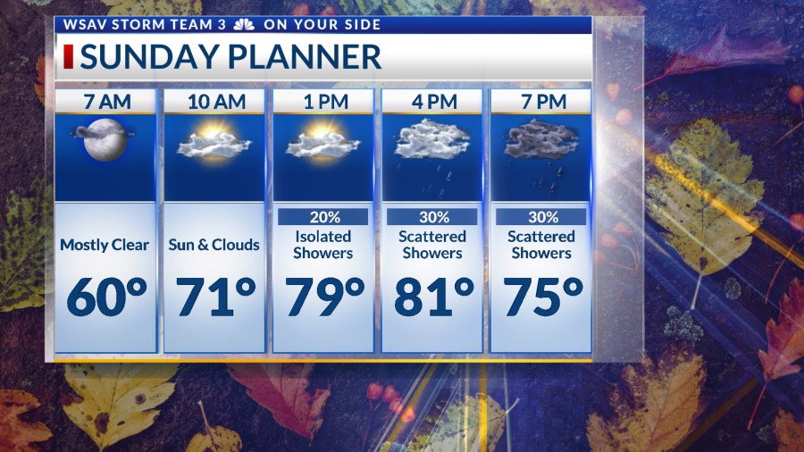
Sunday will dawn with mostly clear skies and a refreshing chill. Thanks to a southern breeze, morning temperatures will be slightly warmer than recent nights, ranging from the upper 50s to the lower 60s.


As the day progresses, expect an increase in cloud cover due to the approaching cold front, which will introduce some showers by late afternoon and evening. Before the front’s arrival, temperatures are anticipated to climb into the lower 80s.
While there may be occasional heavy rain, most precipitation will be light to moderate, with a few isolated thunderstorms possible. The showers will travel from west to east across the region.
Showers are expected to reach the western counties around 2 p.m., moving towards the coast by 5 to 6 p.m., and diminishing as the evening progresses.
Throughout Sunday, conditions will be breezy and gusty, with sustained winds from the south at 10-15 mph and gusts reaching up to 25 mph.
The cold front will be moving off of the coast heading into Monday morning which will help clear the sky out. Monday through Friday will be mainly sunny and warm.
Afternoon highs all week will range from the mid 70s to lower 80s.
Another system is expected to move in for next weekend which will also bring the next chance for showers on Saturday and into Sunday.

TRACKING THE TROPICS
The National Hurricane Center (NHC) is monitoring two systems for tropical or subtropical development in the Atlantic basin over the next week or so.
The first system is a tropical wave that is located about 400 to 500 miles east of the Windward Islands. It is moving west toward the Caribbean Sea. The environment that this system is in right now over the Atlantic will not support significant development within the next two days.
However, the environment will be more conducive of development once this tropical wave enters the Caribbean over the next few days.
The overall chance of this system becoming a tropical depression or tropical storm over the next two days is low (10%). Development chances increase to a medium (40%) risk over the next 5-7 days.
While it is worth keeping an eye on the forecast for this system, there are a few factors working against this becoming a threat to the U.S.

Several fronts are forecast to move off of North America over the next week or so which would help steer the system away. Added windshear from the fronts would also help to weaken and tear apart a tropical system.
Water temperatures in the Gulf and western Atlantic are starting to cool off because of cold fronts moving well south of the U.S. now that we are getting deeper into fall.
This system poses no threat to the U.S. right now.
A second system that the NHC is monitoring is located several hundred miles east of the U.S. It has a low (10%) chance of becoming a subtropical low. This system is moving east away from the U.S.
Regardless of development, it poses no threat to land.