SAVANNAH, Ga. () — Mild conditions continue into this weekend, with rain chances on the way.
Friday was warm and breezy in our area, with temperatures reaching the low to mid 80s and winds of 10-15 mph, occasionally gusting to 25 mph.
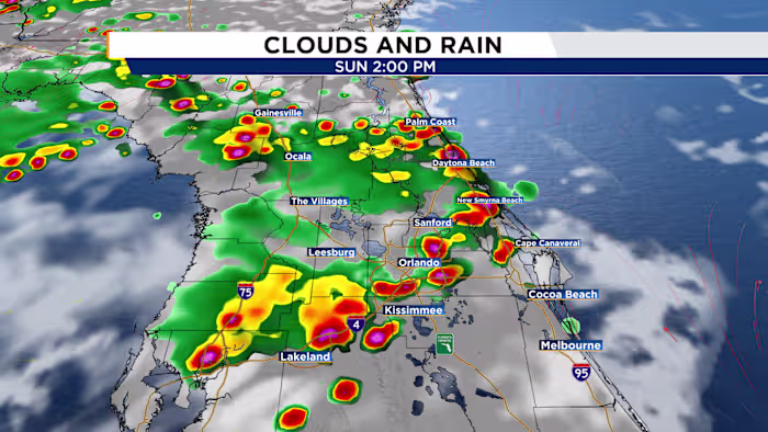
The first weekend of October will see changing conditions. Saturday will have more cloud cover and a 40% chance of rain. Showers will occur intermittently throughout the day, but a washout is unlikely.
A mid-level disturbance will cause a slight wind shift and add more moisture by the end of the weekend. There’s a 60% chance of rain on Sunday and Monday, with periods of soaking rain possible. Most rain will fall south of I-16, though the Lowcountry may experience occasional showers.
Elevated winds and persistent onshore flow, combined with astronomical high tides, could lead to minor coastal flooding. Saltwater flooding is possible in low-lying areas around high tide.
Rain chances decrease to 20-30% for the rest of the week as easterly flow off the Atlantic brings passing showers. Weakening high pressure will keep winds from the east, allowing for a warmer and more humid pattern for much of next week, with morning temperatures in the upper-60s to lower-70s and afternoon highs slightly above average in the low to mid 80s.


A cold front is expected to enter the region by late-week, potentially forming a storm system by week’s end. Rain chances will persist, and a return to mild conditions might occur if stronger high pressure builds to our north.
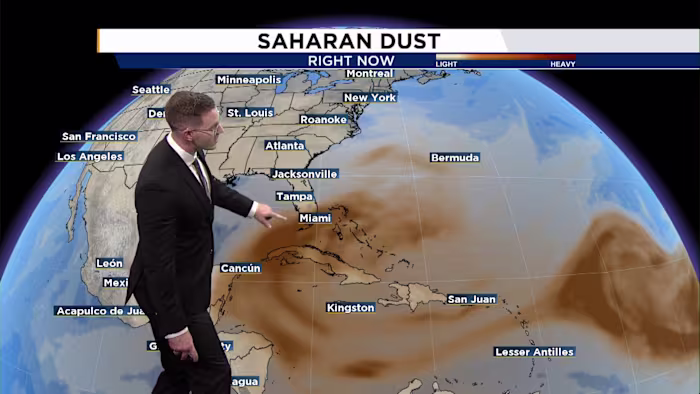
The tropics don’t feature many changes, with an area of disturbed weather off the coast of Florida, and a tropical wave moving off the coast of Africa.
The disturbance closer to home has a 10% chance of developing into a tropical depression or named storm. The window for this system to develop is closing as strong wind shear will put a lid on its chances.
A tropical wave moving off the west coast of Africa has a 50% chance of developing over the next seven days. Expect this system to slowly organize as it gets closer to the Caribbean next week. It bears watching as it tracks further west.
There are currently no tropical threats for the Coastal Empire and Lowcountry.