
Share this @internewscast.com
Meteorologists have issued a warning regarding a developing tropical system in the Atlantic Ocean, indicating it could become a significant threat in the upcoming weeks.
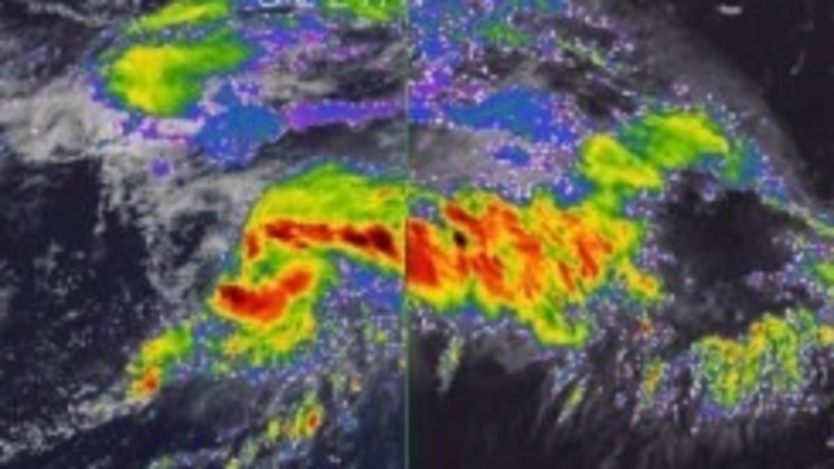
AccuWeather is currently monitoring a tropical wave just off the coast of Africa, which is anticipated to reach the eastern Caribbean islands by the end of this weekend.
These tropical waves, which originate over Africa or the Indian Ocean, consist of clusters of scattered showers and thunderstorms that gradually move westward across the Atlantic Ocean.
While many tropical waves remain weak and disorganized, approximately one in every three to five can intensify under the right conditions, eventually evolving into a named tropical storm.
The next names in line for tropical storms in the 2025 Atlantic hurricane season are Melissa and Nestor.
“Meteorologists are observing what may develop into the next significant threat to lives and property across the Caribbean, Central America, and possibly the United States before October ends, marking the final stages of the Atlantic hurricane season,” AccuWeather reported.
Meteorologists noted multiple scenarios could play out, with one steering the storm northward to Florida.
‘In a worst-case scenario, the wave could organize into a tropical storm over the central Caribbean and move northward with a track near the US Atlantic coast,’ they warned.

Meteorologists are monitoring a tropical wave moving west in the Atlantic Ocean, warning it could intensify in the coming days as it barrels closer to the US
AccuWeather chief on-air Meteorologist Bernie Rayno said in a statement: ‘This is the tropical wave that could go on to define the Atlantic tropical season in terms of impact, should it get past hurdles in the coming days.’
However, the weather outlet noted that the tropical wave has a long way to go before entering the open waters of the Caribbean.
Forecasters expect it to remain weak and disorganized until it moves past the eastern islands marking the entrance to the Caribbean Sea later this weekend.
AccuWeather lead hurricane expert Alex DaSilva said: ‘Tropical storms can develop from other means, especially near the beginning and tail end of the season, so the risk of development will extend well beyond one of the final tropical waves of the season.’
As the system approaches the Caribbean, its close position to the northern coast of South America may slow its development.
However, if it moves far enough away from land, conditions such as low wind shear could allow it to strengthen more easily.
Additionally, a high-pressure area above the system could create an environment for rapid intensification, AccuWeather reported.
While the path of the potential storm is unknown, it could follow a similar route to Hurricane Sandy in 2023, which hit New Jersey and New York.

Meteorologists shared predictions, showing parts of the US that could be impacted by tropical rain and wind starting next week

In a worst-case scenario, the wave could organize into a tropical storm over the central Caribbean and move northward with a track near the US Atlantic coast
AccuWeather meteorologists emphasize that while this is not the most likely scenario at this time, there is a wide range of development and track possibilities.
‘However, based on the anticipated weather pattern and historical records, the Caribbean could be the spot for the next tropical storm and hurricane to form and affect populated areas from next week to the end of the month,’ meteorologists said.
The Atlantic hurricane season officially continues through November 30.
As the peak period for tropical waves winds down in late October and November, new storms typically form near Central America, the central Atlantic, and the waters off the southeastern US coast.
By October 15, the season had produced four hurricanes, three of which reached major hurricane strength with sustained winds of 111 mph or higher.
In addition, there have been 12 named tropical storms and one unnamed storm of strong winds and heavy rain that impacted the US East Coast from October 10–14.