
Share this @internewscast.com
A region already reeling from floods is now preparing for the arrival of a potentially ruinous cyclone, heightening concerns about the impending impact on northern Australia.
Tropical Cyclone Narelle has emerged in the Coral Sea and is advancing toward far-north Queensland. This marks the third weather system to threaten the waterlogged area in less than eight weeks.
Forecasters predict the cyclone will hit land just north of Cairns on Friday, bringing with it fierce winds and heavy rain, which could lead to severe flooding.
By early Wednesday morning, the cyclone, classified as a category-two storm, was positioned approximately 1000km east of Cooktown. It was generating sustained winds of 110km/h at its core, with gusts reaching up to 155km/h.
As Cyclone Narelle approaches the coast, it is anticipated to escalate to a category-four storm, with wind gusts surpassing 200km/h, raising the likelihood of extensive structural damage.
This would be the first category-four cyclone to strike Queensland since Cyclone Debbie in 2017, which inflicted massive destruction on the Whitsunday Islands and resulted in billions of dollars in losses.
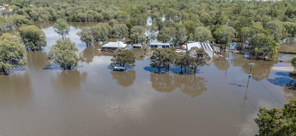
Queensland is still reeling from flooding caused by back-to-back storm systems.
A tropical low caused record-breaking rainfall across the state’s north and west in February.
Another low crossed the far north coast earlier in March, dumping more heavy rain on the region.
Cyclone Narelle is forecast to move west from Queensland and cross the Gulf of Carpentaria before hitting eastern parts of the Northern Territory, potentially bringing more rain to already swamped Top End communities.
It may then make a rare, third border crossing into Western Australia’s north.
A cyclone watch zone is in place from Lockhart River on the Cape York Peninsula south to Port Douglas and adjacent inland areas in Queensland.
Gales with damaging wind gusts up to 120 km/h are possible between Cape Melville and Port Douglas from early Thursday.
Destructive wind gusts up to 155 km/h are possible between Coen and Cooktown north of Cairns from Thursday night.
Heavy rainfall leading to flash flooding is possible between Cape Melville and Port Douglas from Thursday evening, extending inland during Friday.
Tides will be higher than normal between Coen and Port Douglas, the Bureau of Meteorology said, with large waves causing dangerous flooding in low-lying coastal areas.
For the latest from SBS News, download our app and subscribe to our newsletter.