
Share this @internewscast.com
A pair of distinct trough lines swept across the state, unleashing torrents of rain from midday to midnight. The city experienced its most intense October downpour in half a decade.
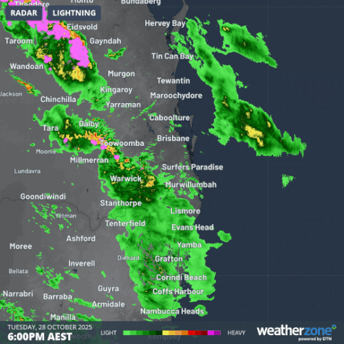
According to Weatherzone, several areas across the state reported rainfall exceeding 100mm within 24 hours by this morning.

Oyster Creek, situated near Burleigh Heads, came close to receiving 130mm of rainfall.
The weather patterns extended into the northeast of New South Wales as well, where Goonengery, located inland from Byron Bay, recorded 123mm of rain, Weatherzone reported.
In Brisbane, the airport registered 61mm of precipitation, marking the highest amount since Cyclone Alfred struck the city in March.
The city was already in a state of recovery after severe storms had left 21,000 households without electricity on Monday night.
More than 11,000 insurance claims were made across the city after ferocious winds brought down trees and damaged properties across Brisbane.
Skies have cleared across much of Queensland today but showers and storms are expected to stick around for much of the week.