
Share this @internewscast.com
Recent analyses from both national and international weather agencies indicate that the developing weather pattern could intensify beyond initial predictions.
Should the temperature rise exceed two degrees above the norm, this could lead to what is referred to as a “super” event.
Such phenomena are uncommon, typically happening only once every 10 to 15 years.
Australia has experienced only three super El Niño events since 1982, with the last occurring in 2015.
The U.S. National Oceanic and Atmospheric Administration (NOAA) has noted there is a one-in-three probability that this year’s El Niño could reach significant strength.
“While model forecasts tend to be less precise at this time of year, the growing likelihood of an El Niño event is backed by the considerable heat present in the subsurface ocean and the anticipated weakening of the low-level trade winds,” the NOAA stated in its most recent update.
“If El Niño forms, the potential strength remains very uncertain, with a one-in-three chance that it would be ‘strong’ during October-December 2026.”

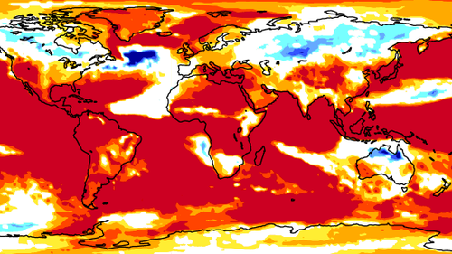
The Bureau of Meteorology did not speculate on the strength of the El Niño but has forecast warmer-than-average sea temperatures in eastern and southern parts of the country from April to June.
Up to three degrees warmer than average temperatures are anticipated for the western Tasman Sea. 
“All models indicate a shift to El Niño is possible by the end of winter, however there is variation on the timing of this transition, with some suggesting development as early as May, while others delay onset until late winter,” the Bureau of Meteorology said.
Weather and climate expert Ailie Gallant said the strength of the event will not be clear until around June.
“The European models and the US models and the Australian models at this stage are all forecasting for the central and eastern Pacific to be warmer than normal,” the Monash University Centre of Excellence for Weather of the 21st Century’s associate professor said.
“But there’s this thing in climate science called the autumn predictability barrier, which tells us that what we forecast from February through to May is very uncertain.
“So while the tendency is in that direction, being able to say right now whether it will be a weak El Niño or a super El Niño is very premature.”

El Niño, La Niña and neutral are all stages of the El NiñoâSouthern Oscillation climate cycle, which is an atmosphere and ocean phenomenon in the Pacific that occurs every three to eight years and disrupts weather patterns around the world.
El Niño is linked to drier conditions, while La Niña is associated with wetter conditions.
Gallant said these cycles only form part of the story, and other weather events like cyclones and tropical lows also impact conditions. 
“El Niño tips the scales towards being drier in the east, but individual weather systems can change that on a dime,” she said.
“We’ve had plenty of examples where El Niños have been very, very dry, but we’ve also had plenty of examples where El Niños have been much wetter than expected.”
Last month, meteorologists began forecasting that a weak spell of La Niña that started in November is coming to an end.
The last El Niño event formed in 2023 for the first time in eight years and on the back of a triple La Niña from 2020 to early 2023.
NEVER MISS A STORY: Get your breaking news and exclusive stories first by following us across all platforms.