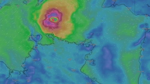

Cyclone Fina has intensified to a category 2 storm and is projected to veer towards the Northern Territory coastline on Thursday, potentially unleashing powerful winds in certain regions.
The Bureau of Meteorology issued a warning late Wednesday night (early Thursday AEDT), cautioning that destructive winds reaching speeds of up to 135 km/h could develop later on Thursday or into Friday, accompanied by heavy rainfall and perilous storm surges.
Marking the season’s first cyclone, Fina holds the potential for a significant and historic landfall in the coming days.
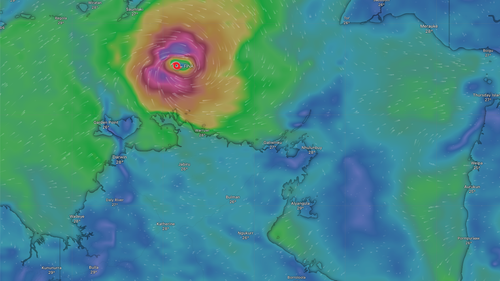
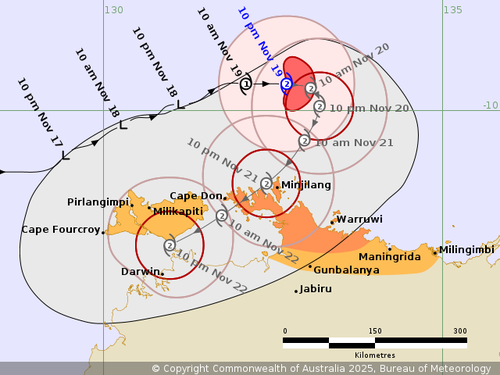
By 9:30 pm (11 pm AEDT) on Wednesday, the cyclone had reached category 2 status after intensifying more swiftly than meteorologists had anticipated, off the north-northeast coast of the Northern Territory.
At that time, Fina was positioned approximately 370 kilometers north-northeast of Darwin and 170 kilometers north of Minjilang on Croker Island.
The bureau anticipated that the sluggish cyclone would shift southward towards the northern coastline of the Top End on Thursday, with a turn towards the southwest expected on Friday and continuing into Saturday.
Gales with damaging wind gusts of 120km/h were expected between Cape Don and Warruwi throughout Thursday, later strengthening to destructive 135km/h gusts. 
Heavy rainfall leading to possible flash flooding was predicted for Friday along coastal areas between the Tiwi Islands and Millingimbi, following higher than normal tides as early as Thursday morning.
“Hotham and Maningrida are specifically warned of a dangerous storm tide as the cyclone centre crosses the coast during Friday and Saturday,” the bureau said.
“Tides are likely to rise significantly above the normal high tide, with damaging waves and dangerous flooding.”
People near Cape Don, Warruwi and the area in between were warned to “immediately commence or continue preparations, especially securing boats and property, using available daylight hours”.
Residents in Darwin were urged to remain vigilant as Fina edges closer to the coast on the weekend.
The worst of the impact will be felt in Darwin over the weekend, including gale-force winds, storm surges and heavy rainfall.
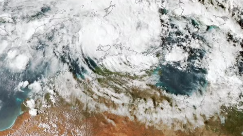
Several different scenarios could play out however residents on the NT coast were told to brace for some severe weather.