Share this @internewscast.com
An icy combination of thunderstorms, hail and snow is set to envelop the south-eastern states this long weekend.
A low-pressure system is ushering in a cool wave of air across New South Wales, the ACT, Victoria, South Australia, and Tasmania starting today and lasting through the King’s Birthday public holiday on Monday.
It will bring rain and hail over large parts of the states, according to Weatherzone.
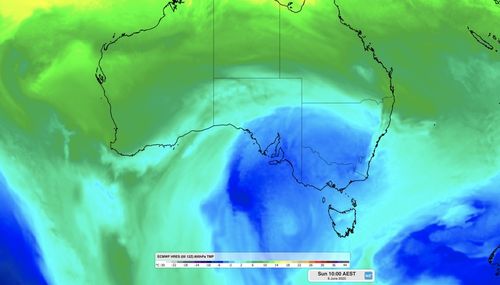
The Bureau of Meteorology predicts temperatures dropping to below freezing in Canberra, four degrees in Hobart, six degrees in Adelaide and Melbourne, and eight degrees in Sydney.
The cold weather, coupled with clouds and wind, will leave conditions feeling even cooler than forecast.
It will lead to some low-level to heavy snowfall in mainland alpine regions from tomorrow into at least Tuesday, according to Weatherzone.
The system is expected to deliver enough natural snow to start off the ski season in NSW, the ACT and Victoria this winter.
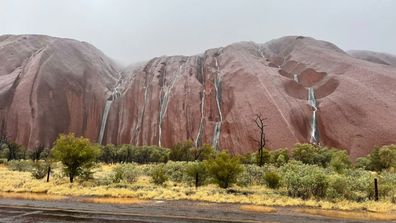
Tourists come across extraordinary sight at Uluru
Mt Hotham is forecasting up to 60cm of snow, and Perisher is expecting 2cm.
Conditions will pick up in the south-eastern states tomorrow and move north on Sunday before beginning to clear on Monday.
The remaining states and territories will experience mostly dry conditions over the long weekend.