
Share this @internewscast.com
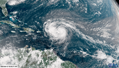
Currently a rare Category 5 storm, Erin is moving through the Atlantic Ocean, north of the Caribbean.
Erin went from a Category 1 hurricane with 120km/h winds at 11am local time Friday to a Category 5 with near 257km/h winds just over 24 hours later.
They aren’t quite as warm as the record levels reached in 2023 and 2024, but are still far warmer than they’d be in a world that wasn’t heating up.
Erin marks the first major hurricane of the Atlantic season. Prior to Erin, four other systems – Andrea, Barry, Chantal, and Dexter – traversed the Atlantic but did not surpass tropical storm strength.
The initial hurricane of the season usually materializes around August 11, so Erin’s arrival was somewhat delayed, especially in contrast to earlier appearances in recent years.
There had already been three hurricanes – Beryl, Debby and Ernesto – by August 15 last year.
August typically signals heightened activity in the tropics, with the most active period extending from mid-August to mid-October. This year, meteorologists predict a higher-than-average level of tropical storm activity.