
Share this @internewscast.com
After much anticipation, the true depth of the lake has been unveiled, with its deepest point reaching slightly over 163 meters. This remarkable discovery provides a fresh perspective on the lake, thanks to the detailed mapping conducted by CSIRO.
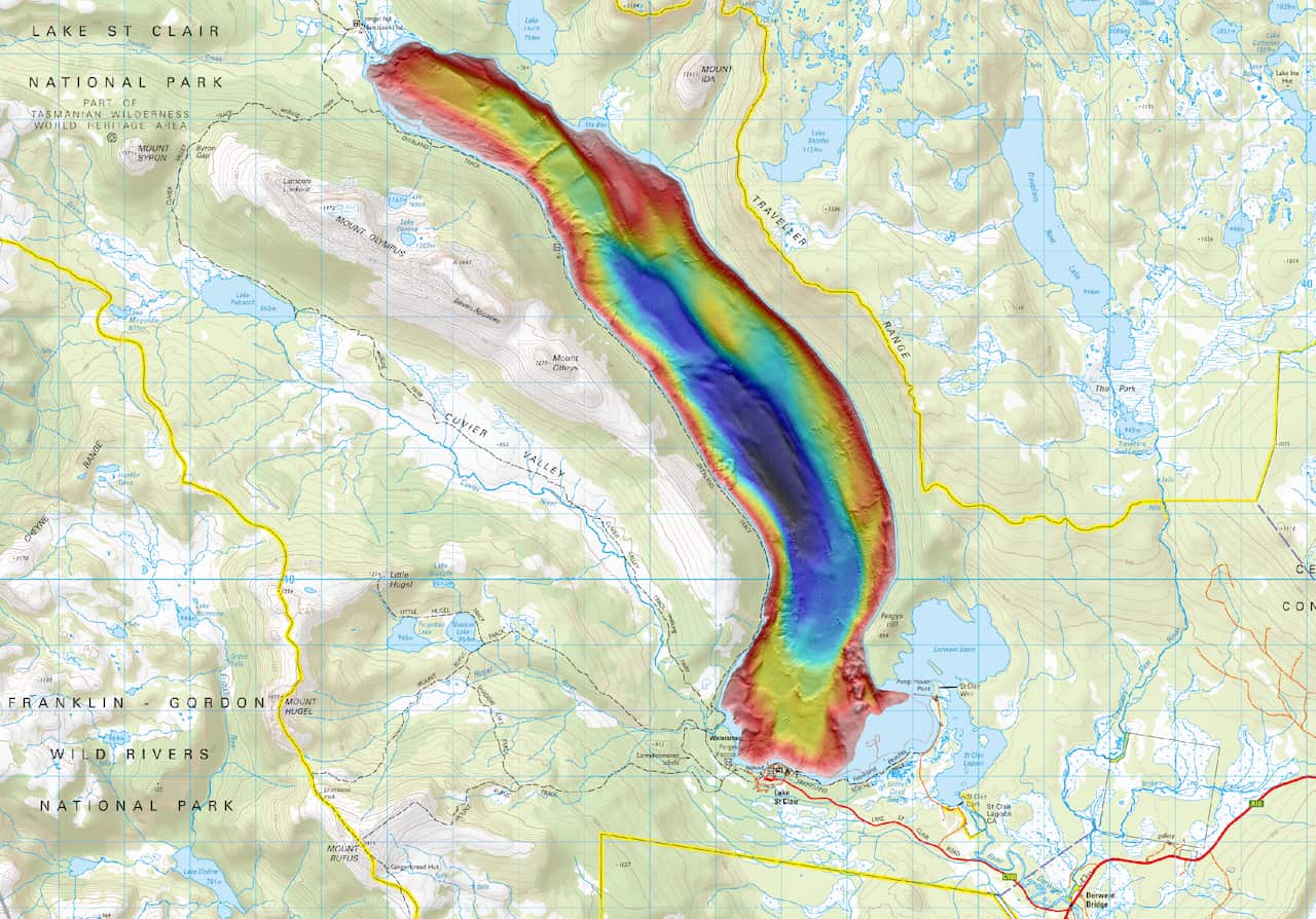
Newly released imagery, courtesy of CSIRO, offers an impressive visualization of the lake’s topography, showcasing its true depth for the first time. The high-resolution mapping, which overlays a topographical map of central Tasmania, has uncovered fascinating details about Lake St Clair.
The deepest point is located towards the south on the western side of the lake, nestled in a corner that has clearly been sculpted by glacial activity. As one expert noted, “We can almost see how the glacier would have really ground through that corner.”
This groundbreaking discovery was made possible by a multi-beam device mounted on the CSIRO vessel, RV South Cape. As the vessel journeyed across the lake, it emitted pulses of sound to accurately measure the water’s depth, providing an unprecedented view of the lake’s underwater landscape.
A multi-beam was mounted onto CSIRO vessel RV South Cape as it travelled up and down the lake, using pulses of sound to measure the water depth, revealing a view of the lake never seen before.
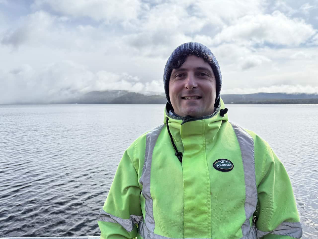
CSIRO hydrographic surveyor Augustin Déplante was part of the nine-day expedition. Source: SBS News / Kerrin Thomas
“Seeing the sharp cliffs on the edges of the lake, we can clearly see some areas that have been carved by the glacier,” Déplante said.
“It can go really shallow into regions, less than less than two meters, even less than a meter as well as long as there’s no hidden rocks or anything underneath the surface,” CSIRO research engineer, Dr Hui Sheng Lim, said.
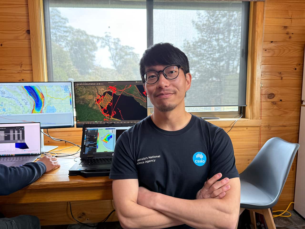
Dr Hui Sheng Lim was among the CSIRO researchers who mapped the lake. Source: SBS News / Kerrin Thomas
“So those are the areas where the big vessel won’t be able to get to.”
“You can see a meter here, and then next moment you are in a 10-metre zone, and next moment you’re already 30 metres, 50 metres deep.”
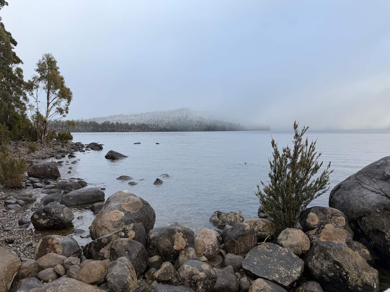
The area is known for its strong winds and unpredictable weather. Source: SBS News / Kerrin Thomas
Otter can also operate autonomously, following a precise, pre-planned path.
“One of the most useful features is we will be able to autonomously find gaps and find the best way to cover those missing gaps in our data sets,” he said.
‘Most peaceful place on this planet’
“It’s the most phenomenal place to swim, because it’s the cleanest air and the cleanest water in the world.”
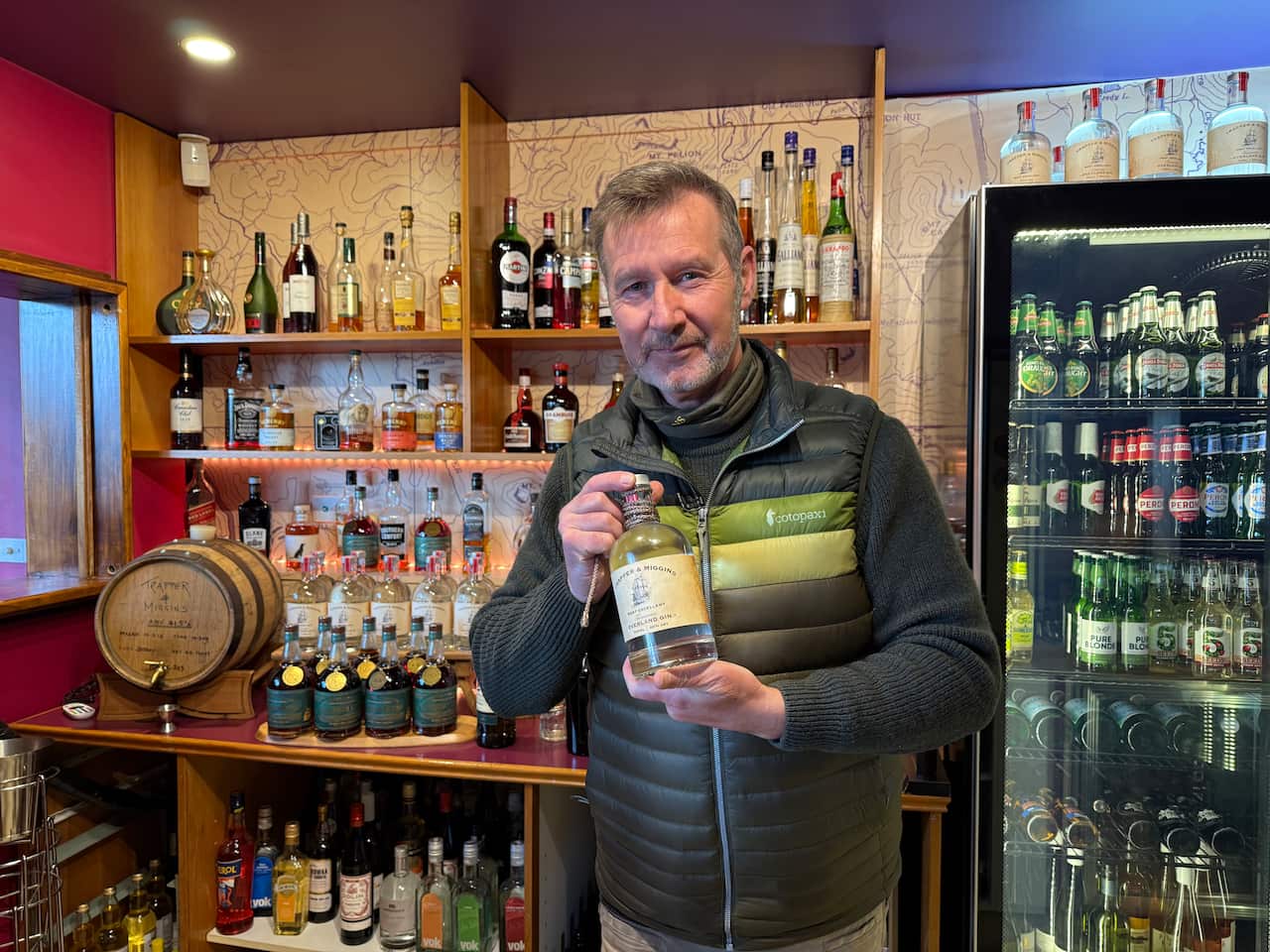
One of Michael Croghan’s most prized possessions is a bottle of gin lowered to the bottom of the lake. Source: SBS News / Kerrin Thomas
One of his prized possessions is a bottle of gin a team of researchers lowered to the bottom of the lake a few years ago.
“It’s now been depth tested I think that was to about 120 metres,” he said.
Snow, wind and swell
“Being on a small boat, like South Cape, sometimes I felt like I was in the Southern Ocean, basically.”
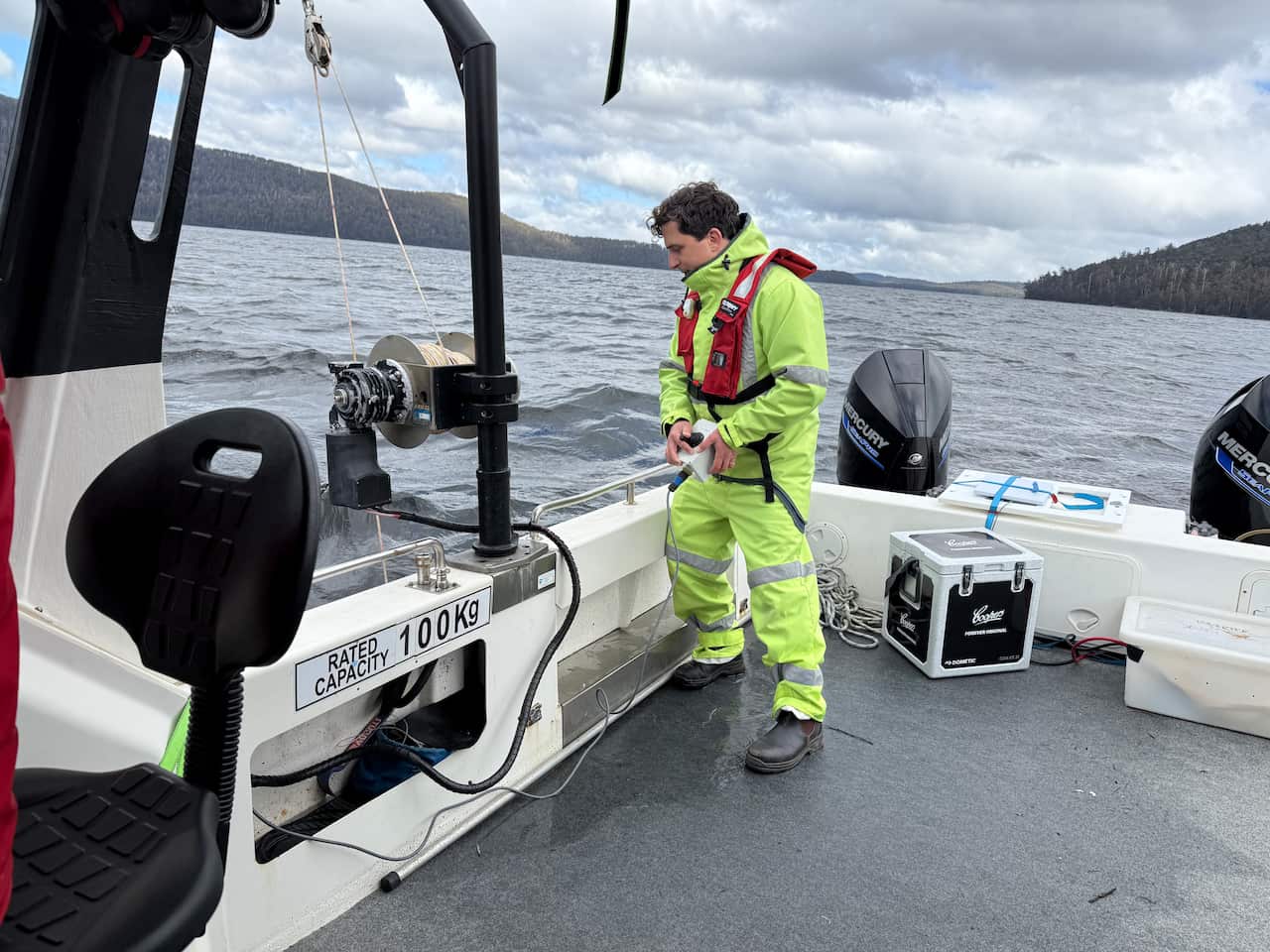
The team encountered snow, big swells and blustery winds as they conducted their research. Source: SBS News / Kerrin Thomas
The detailed data collected will be made public, providing an important resource, it’s hoped will fuel further study of Lake St Clair.