
Share this @internewscast.com
Residents throughout south-east Victoria, including those in Melbourne, are bracing for severe weather conditions today, marked by intense afternoon storms and cyclonic winds that could exceed speeds of 100 km/h.
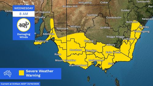
The Bureau of Meteorology issued a severe weather warning early this morning, alerting the public at 4 a.m. about the impending conditions affecting most of the state.

This turbulent weather is the result of a low-pressure system that has formed off the southern coast of South Australia, now making its way eastwards. According to the Bureau, this system is expected to unleash damaging wind gusts this afternoon, which could persist into tomorrow morning.
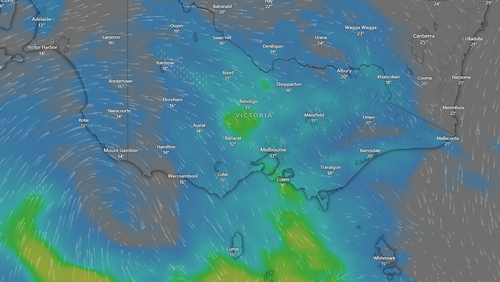
Affected areas include a broad stretch covering greater Melbourne, as well as regional centers such as Horsham, Warrnambool, Bendigo, Shepparton, Seymour, Maryborough, Ballarat, Geelong, Wangaratta, Traralgon, and Bairnsdale.
Particularly hard-hit will be Cape Otway on Victoria’s southern coast, where winds are forecast to reach a staggering 130 km/h.
Gale-force winds, ranging from 100 to 120 km/h, are predicted to develop over the far south-west later tomorrow morning. These winds are expected to advance towards Geelong and the Mornington Peninsula by early afternoon, eventually impacting south Gippsland by mid to late afternoon.
The state’s emergency service has told residents to avoid standing or parking under trees and to be aware of loose items which could turn into missiles during strong winds.
WorkSafe Chief Health and Safety Officer Sam Jenkin also warned employers to keep staff safe during the wild conditions.
“When winds pick up, unsecured materials and unstable structures can collapse, crush or strike workers and members of the public,” Jenkin said.
“Every site needs a clear strategy for managing severe weather so tools, materials and debris don’t become flying hazards.”
Jenkin pointed out that cranes were particularly vulnerable to tip-overs or structural damage during severe weather events.
“Workers and members of the public were lucky to avoid injury when a tower crane collapsed in similar conditions on a Derrimut construction site in August, bringing down power lines and causing extensive damage,” he added.
“This shows how quickly things can go wrong and the importance of following manufacturer instructions for stowage or configuration of cranes during high winds like we’re expecting across the state today.”
Thunderstorms later today are also likely, however only light rain of up to 5mm in the Melbourne metro area is expected.
The wild weather is set to ease tomorrow, with only moderate winds forecast for south-east Victoria.
Destructive weather battering SA
Similar conditions are also expected across South Australia today and tomorrow.
The BoM has issued severe weather warnings for damaging and locally destructive winds, marine wind warnings, and a sheep graziers warning across the state.
The most destructive winds are expected in the Mount Lofty Ranges, Kangaroo Island, Upper South East, Lower South East and parts of the Mid North and Murraylands districts.
There is also a risk of locally destructive gusts along the coast south-east of Robe.
Adelaide is forecast to be drenched with around 30mm of rain today as storms develop into the afternoon.
Bushfire warning in NSW as millions face catastrophic heat
The Bureau of Meteorology has cancelled a heatwave warning for NSW but Sydney is still set to hit a top of 39 degrees today.