
Share this @internewscast.com
Hi there – StormTeam3 Meteorologist Alysa Carsley here – let’s have a fabulous Thursday!
We’re experiencing a similar weather pattern today, with afternoon temperatures reaching the low 90s. This morning, a trough is beginning to move into our inland areas, and it will gradually proceed toward the coast throughout the afternoon. Isolated showers and thunderstorms are anticipated through this evening.
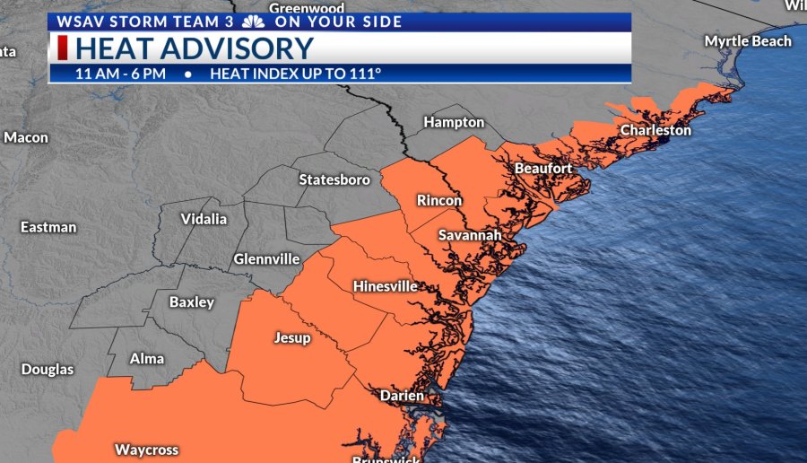
If you’re looking for relief from the hot afternoon, unfortunately, only brief cool downs will occur if you catch a rain shower. Otherwise, temperatures will stay in the 90s. A heat advisory is in effect from 11 am to 6 pm, with the heat index possibly reaching up to 111°.

A cold front is predicted to move slowly through the area tomorrow, which could bring scattered storms as we conclude the workweek. Temperatures will remain in the mid-90s before the front, and will only slightly drop to the lower 90s after it passes. Unfortunately, no significant cooling is expected. The summer heat will continue into next week. The front will linger to our south on Saturday, maintaining a chance for scattered storms. It won’t be a weekend washout, but keeping an umbrella handy is a good idea.
THURSDAY TROPICS: Tropical Storm Erin
As of the 5 am update, Tropical Storm Erin has maximum sustained winds of 50 mph. The National Hurricane Center’s forecast track shows no major changes. Erin is still projected to move west, intensifying into a hurricane and possibly becoming a major hurricane early next week.
High pressure is directing Erin westward. By late in the weekend or Monday, this high pressure will weaken, allowing Erin to begin turning north. A trough emerging off the east coast will help steer Erin north around the weakening high, keeping the storm away from the East Coast.
We may experience indirect effects along our coast, which is typical when an offshore system is nearby. Expect increased risks of rip currents and rough surf. Erin’s potential northward turn is still days away, so we will keep monitoring its path closely.