
Share this @internewscast.com
Good morning – StormTeam 3 Meteorologist Alysa Carsley here – let’s have a fabulous Friday!
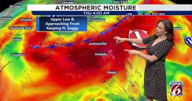
Today’s weather pattern continues much like it has been, and this will carry on through Father’s Day weekend. Scattered thunderstorms will start forming along the coast at first and then move west past I-95 due to the sea breeze. Some of these storms might strengthen, bringing strong winds and heavy rain showers. Temperatures are set to reach the upper 80s to lower 90s, while the heat index could exceed 100°F because of extremely high humidity levels. Rainfall tends to lessen every evening.

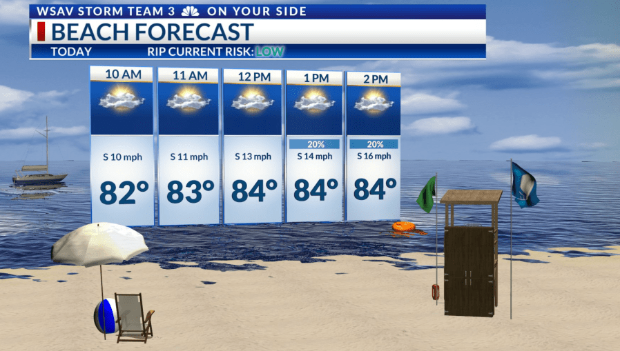
For Father’s Day weekend, there is a chance for rain both mornings, though the likelihood increases during the afternoon and evening hours. The ideal time to celebrate Father’s Day is in the morning, as this is not only the driest period but also the coolest compared to the hotter afternoon. High temperatures will stay in the lower 90s. If you plan to be outside, remember to watch the weather and stay hydrated.


Moving into early next week, the probability of rain will slightly decrease, with only occasional showers and storms expected each day. As a result, temperatures will climb to the mid 90s, and humidity levels will push the heat index to 105°F or greater daily. Heat advisories may be necessary by the end of the week.