
Share this @internewscast.com
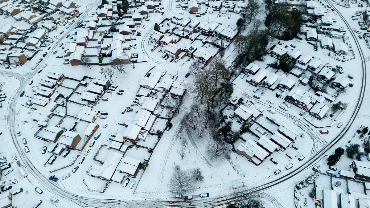
Britain is gearing up for another round of harsh winter conditions as the Met Office has elevated a snow and ice warning to an amber alert. Certain regions are poised to receive nearly a foot of snow as Storm Goretti continues to batter the country.
The amber warning is set to take effect at 3 a.m. on Sunday, impacting areas from the North East of Scotland through Tayside and Central Scotland. This alert will remain active until 2 p.m.
Weather experts have cautioned about the potential for severe travel disruptions, power outages, and even risks to life and property as the harsh wintry conditions persist into a second weekend.
Across other parts of the UK, yellow warnings for snow, wind, and rain have been issued, with National Rail alerting travelers to expect disruptions across England, Wales, and Scotland throughout the weekend.
On Saturday, officials from the Scottish government, police forces, local councils, and various agencies convened to strategize their response to the escalating weather situation.
Forecasters predict an additional 2 to 5 centimeters of snow at lower elevations, with up to 30 centimeters possible in higher regions, sparking concerns that some areas could experience snowfall reaching nearly a foot.
Transport Scotland warned of ‘challenging conditions’, possible route closures and the threat of power cuts, adding there was a potential risk to life and property.
Around 28,000 properties were without power in the South West at 6am on Saturday, according to the National Grid, along with close to 1,700 in the West Midlands and around 150 in the East Midlands. Power has since been restored to all homes in Wales.
Downing Street said support was being offered to households left without electricity.

Britain is bracing for another blast of wintry chaos after the Met Office upgraded a snow and ice warning to amber on Sunday

Snow settles around the A465 in the Dowlais area of Merthyr Tydfil in South Wales on Friday

A pony walks though a frosty landscape as the sun rises in the New Forest, Hampshire

Birmingham wakes up to a thick covering of snow on Friday morning as Storm Goretti sweeps in
Forecasters also warned that a dangerous combination of melting snow and heavy rain could significantly increase flood risks in the coming days.
Snowfall totals already recorded include 15cm at Lake Vyrnwy in Powys and 7cm at Preston Montford in Shropshire and Nottingham.
In Scotland, 27cm was recorded at Altnaharra in Sutherland, 26cm at Loch Glascarnoch and 22cm at Durris in Kincardineshire.
The heaviest rainfall was logged in Cornwall, with 61.8mm at Colliford Dam, followed by 57mm at Ddolwen Bridge in Dyfed and 54mm at White Barrow in Devon.
The latest warnings come after police earlier hit out at Instagram-loving tourists for their ‘ridiculous parking’ on a snow-covered Welsh mountain.
Hordes of visitors descended on Snowdonia in North Wales to capture images of the winter wonderland, despite police urging motorists not to abandon vehicles on icy mountain roads.
North Wales Police warned that drivers were putting others at risk of ‘serious’ injury and ‘pushing them into the paths of oncoming vehicles’. Officers said vehicles left dangerously could be towed away if it was safe to do so.
Brazen hikers have also been pictured attempting to climb Snowdon, despite Llanberis Mountain Rescue Team issuing an avalanche warning.
The extreme conditions follow the devastation caused by Storm Goretti, which has battered parts of Britain in recent days. One man in his 50s died after a tree fell onto his caravan amid hurricane-force winds.

A trail of people make their way up Snowdon despite the Llanberis Mountain Rescue Team issuing an avalanche warning

A full car park at the base of Pen y Fan mountain during Storm Goretti

Deserted platforms and a departure board at Old Hill station in Sandwell, West Midlands, on Friday
Emergency services were called to the Mawgan area of Helston, Cornwall, at around 7.35pm on Thursday after the tree fell, with officers working through Friday to safely remove it from the mobile home.
Cornwall has since been lashed by gusts of up to 100mph as the UK braces for further snow, ice and flooding.
A yellow warning for snow and ice remains in place until 3pm on Saturday, with further snowfall possible across parts of northern England and much of Scotland. A widespread risk of ice is also expected to cause disruption.
A separate yellow warning for ice covers large parts of England and Wales until midday on Saturday as partially thawed snow refreezes, alongside wintry showers and freezing fog.
In Northern Ireland, a yellow warning for snow and ice runs until 11am on Saturday, with icy patches and hill snow expected.
Another yellow warning will be in force from 2am until 3pm on Sunday for much of Scotland, the East and West Midlands, north-east and north-west England and Yorkshire. Forecasters say a further 2–5cm of snow is likely, with 10–20cm possible above 200 metres.
Dan Stroud, Met Office meteorologist, said the weather over the weekend will remain ‘unsettled and cold’.

A horde of people walk up Pen y Fan in the Bannau Brycheiniog National Park on January 10

Police have hit out at Instagram-loving tourists for their ‘ridiculous’ parking on Snowdon while it has been covered with snow
He said: ‘Wintry showers will continue to affect some coastal areas on Saturday, although these will increasingly become confined to northern and eastern parts as the day progresses.
‘Elsewhere, after a cold and frosty start, it should be a mostly dry day with variable amounts of cloud. It will be a widely cold day, with frost lingering across parts of the country.
‘Sunday will start dry in the east, but cloud and rain already present in the west will move steadily eastwards.
‘The rain will fall as snow inland across the north Midlands and areas further north. However, temperatures will rise through the day, meaning the snow will become increasingly confined to higher ground by the afternoon.
‘It will be windy for all, with coastal gales and the potential for severe gales in the north west later in the day.
‘The unsettled but increasingly milder theme continues into next week, with persistent rain at times in northern and western areas, along with strong to gale force winds. However, it will feel much milder than recently, with temperatures returning to near-normal values.’