
Share this @internewscast.com
In a startling revelation, British soldiers have inadvertently exposed their positions within one of the UK’s most sensitive nuclear facilities by sharing their exercise routes on the popular fitness app, Strava.
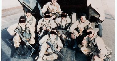
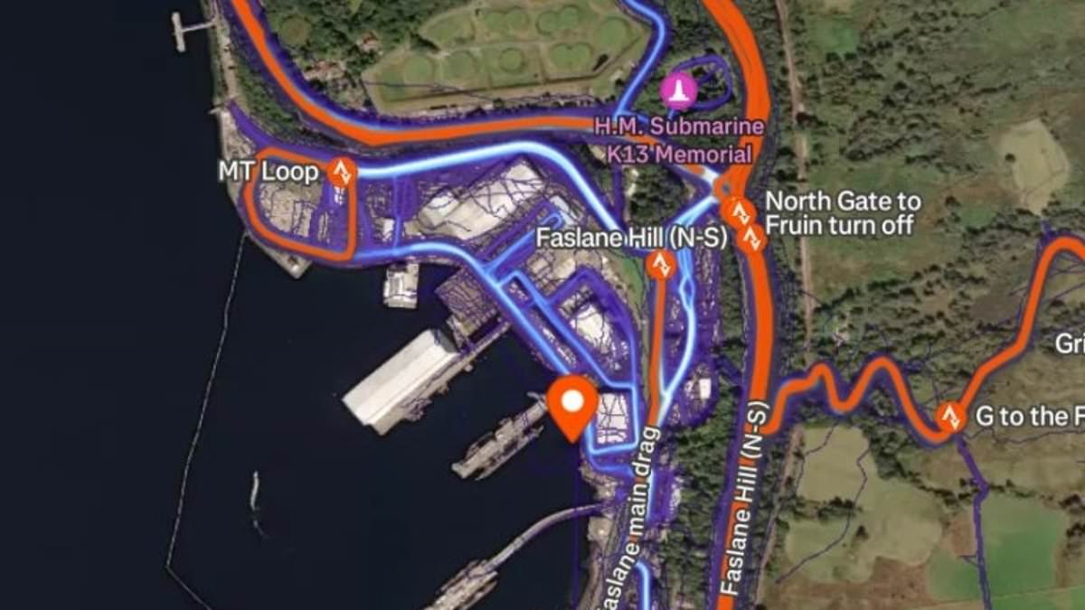
Over 500 members of the British Armed Forces, by publicly tracking their jogging paths, have inadvertently revealed the geographic coordinates of several military installations. This digital breadcrumb trail was uncovered by the i paper, which linked personnel to the military command hub in Northwood. Additionally, it identified 110 individuals associated with the naval base HM Clyde in Faslane, a critical site for the UK’s nuclear deterrent, since the year began.
This inadvertent disclosure has sparked fears about the potential for adversaries to collect intelligence on these high-security locations. There is also concern about the possibility of personal data being gathered on military staff and their families, which could be exploited for coercive purposes.
The issue is compounded by recent instances of drones, proxies, and spies being detected around UK military bases, heightening the urgency of the situation.
In a related incident last month, authorities charged an Iranian man and a Romanian woman for allegedly attempting to breach security at HMNB Clyde in Scotland, also known as Faslane. This base is crucial, as it houses the Royal Navy’s Submarine Service and the UK’s nuclear deterrent, Trident.
Last month an Iranian man and Romanian woman were charged after allegedly attempting to enter HMNB Clyde in Scotland, known as Faslane, home to the Royal Navy’s Submarine Service and Britain’s nuclear deterrent Trident.
The i paper reported one route logged on Strava within the site’s restricted area disclosed details that could help identify the specific nuclear submarine in which the user was assigned.
Another official at the same base posted photos of warships entering the Scottish port on their Strava account.

British soldiers have given away their locations inside one of Britain’s most security sensitive nuclear bases by posting their runs on Strava

More than 500 members of the British Armed Forces publicly tracked their runs on the fitness app, geographically pinpointing several military sites
Personnel stationed at overseas bases, including RAF Akrotiri in Cyprus and Diego Garcia in the Indian Ocean, were also identifiable through the app.
Both bases, which have played a role in the US’s military campaign against Iran, have been targeted in retaliatory attacks.
Since January 519 officers, contractors, staff and relatives logged their workouts across some of Britain’s most sensitive military bases.
The user’s home address, identity of relatives and any linked social media accounts were identifiable with the use of the information on the app.
This is not the first time sensitive information has been exposed through the widely used fitness app.
In 2018 a Strava heatmap of GPS data revealed activity in Faslane, as well as locations including a US Special Operations base in the Sahel region of Africa, a Patriot missile system in Yemen and drone on an airbase in Dijbouti.
Conservative MP Ben Obese-Jecty said the recent lapse in security by the British Armed Forces is ‘beggars belief’.
The former army officer and MP for Huntington wrote on X: ‘I stopped using Strava when I became an MP and I locked down my profile for that. The app has numerous features to enable you to keep your data private.

Personnel stationed at overseas bases, including RAF Akrotiri in Cyprus and Diego Garcia in the Indian Ocean, were also identifiable through the app

Nuclear-powered attack submarine HMS Ambush pictured being trialled from the port of Faslane in Scotland
‘It is beggars belief that our armed forces don’t have a grip of this given the current, and very real, threat posted by sub-threshold activity from our adversaries.’
The French military has faced a similar issue, named StravaLeaks, after a soldier revealed the position of an offshore aircraft carrier last month, as reported by Le Monde.
The crew member logged a 4.3-mile workout lasting around 35 minutes as he ran laps aboard the Charles du Gaulle while it sailed towards the eastern Mediterranean – effectively pinpointing the vessel’s exact location.
Satellite imagery taken shortly afterwards is said to show the distinctive outline of the 262-metre-long nuclear-powered warship in the same area.
The scandal deepened after the locations and movements of 18,599 French personnel were shared across 100 military baes across the world.
A Ministry of Defence spokesperson said: ‘We take the security of our personnel very seriously and keep guidance for them under constant review.’
The use of fitness apps such as Strava do not present an operational threat, with the location of the bases in the public domain, the department suggested.