
Share this @internewscast.com
Meteorologists are losing a sophisticated tool that many say has proved invaluable when monitoring and forecasting hurricanes.
The National Oceanic and Atmospheric Administration (NOAA) revealed in a recent service change notice that it will cease importing, processing, and distributing data from the Special Sensor Microwave Imager Sounder (SSMIS).
“This service change and termination will be permanent,” wrote NOAA.
SSMIS instruments are installed on three weather satellites situated in low-Earth orbit, operated by NOAA in collaboration with the United States Department of Defense. According to NOAA, these instruments provide essential weather data that current satellites and weather tools cannot yet replicate.
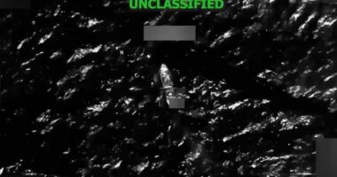
This system enables forecasters to delve into the intricate details of active tropical systems, helping them to comprehend their dynamics better. SSMIS employs microwaves to cut through clouds, offering a clearer view of a tropical cyclone’s internal structure, including pinpointing its precise center.
Other weather satellites use visible and infrared imagery, which can only capture surface-level details of the cloud tops rather than what’s happening inside the cyclone. These satellites are also ineffective after sunset when it’s too dark to see and when direct observations over open water are scarce. Forecasters, therefore, rely on the data collected from the SSMIS system during these periods.
The SSMIS data not only allows forecasters to better monitor the current progress of a tropical cyclone but also to identify the center of the system for weather forecast models.
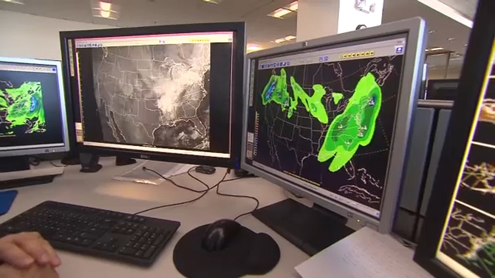
Weather forecast models are sensitive to initial weather conditions and rely on multiple sources of accurate weather data for forecasting. Any degradation or discontinuity in the data, whether in terms of quality or quantity, could negatively affect the model’s forecasting skill, scientists warn.
While there is other microwave data available to forecasters, SSMIS accounts for almost half of all microwave instruments, which would dramatically reduce the data available to forecasters. In a worst-case scenario, forecasters say it could lead to missing a tropical system that intensifies overnight, which would not be apparent from using infrared satellite imagery alone.
The SSMIS system is part of the Defense Meteorological Satellite Program (DMSP), which is operated by NOAA on behalf of the Defense Department’s Space Force, which has satellite control authority.
The DMSP program focuses on the design, development, launch, and maintenance of satellites that track weather patterns, oceanic conditions and solar-terrestrial physics.
A Space Force official told ABC News the U.S. Navy is responsible for processing the SSMIS data and providing it to NOAA and they are referring all questions about the decision to the Navy, which did not immediately respond to ABC News’ request for comment.
In a statement, a Space Force official wrote that “satellites and instruments are still functional.” The official added that Department of Defense users, including the Navy, “will continue to receive and operationally use DMSP data sent to weather satellite direct readout terminals across the DoD.”
Scientists from around the country, meanwhile, expressed their concerns about the decision, stating that it will negatively impact the weather community’s capabilities and accuracy in tracking life-threatening cyclones.
Matthew Cappucci, an atmospheric scientist and senior meteorologist at @MyRadarWX wrote on X, “Please be aware that this change can and will have a negative impact on the forecasts relied upon by Americans living in hurricane-prone areas.”
Michael Lowry, a hurricane specialist at ABC affiliate WPLG in Miami, wrote on his Substack blog, “The permanent discontinuation of data from the Special Sensor Microwave Imager Sounder (SSMIS) will severely impede and degrade hurricane forecasts for this season and beyond, affecting tens of millions of Americans who live along its hurricane-prone shorelines.”
And Brian McNoldy, a hurricane researcher at the University of Miami, wrote on Bluesky that “For anyone near a hurricane-prone area, this is alarmingly bad news.”
Space Force told ABC News that while the U.S. Navy’s Fleet Numerical Meteorology and Oceanography Center (FNMOC) “is making a change on their end, the posture on sharing DMSP data has not changed,” noting that NOAA has been making DMSP data publicly available, and that many non-Defense Department entities use this data.
Copyright © 2025 ABC News Internet Ventures.