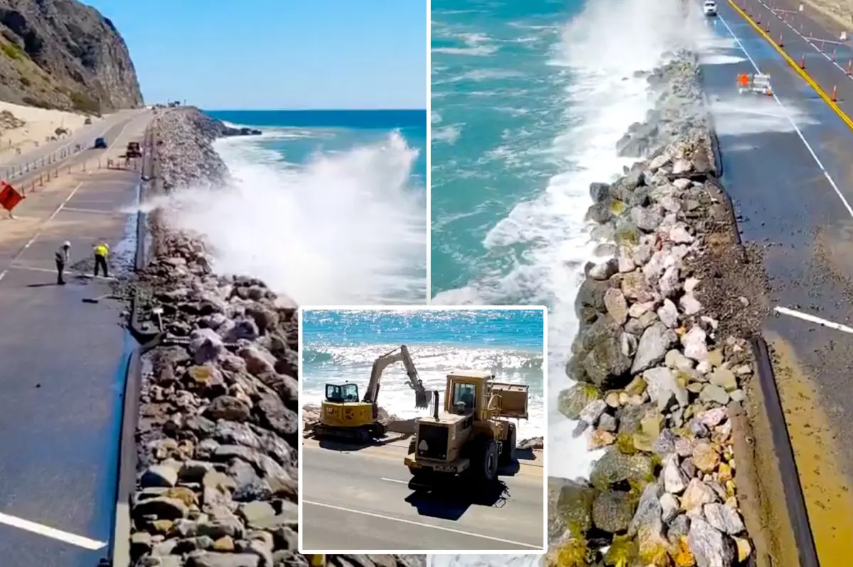

California crews are racing to prevent the iconic Pacific Coast Highway from being eaten away by the ocean as powerful surf, rising tides and a potentially severe El Niño winter intensify pressure on the state’s shoreline.
Caltrans said Friday that workers have begun installing a rock barrier along State Route 1 near Thornhill Broome Beach in Malibu, where recent storms destroyed part of the roadway.
“In advance of an El Nino winter, crews are constructing Rock Slope Protection (RSP) on this shoreline along State Route 1 north of Sycamore Canyon Road, where a section of highway washed out in SoCal’s most recent storm,” the agency said in a social media post.
The emergency work consists of placing enormous boulders along the exposed coast to reduce the risk of additional erosion. Caltrans footage showed excavators and bulldozers shifting soil and hauling rocks into position.
According to Caltrans, rock slope protection is a widely used erosion-control technique designed to offer lasting protection for transportation infrastructure and, above all, the people who use it.
Meanwhile, the rough coastal conditions are already making the drive more difficult for motorists.
The California Highway Patrol said unusually high tides are affecting traffic on the same section of Highway 1. Construction along the shoulder has also prompted officials to modify traffic patterns.
“High tides along the coast are impacting travel along SR-1 in the area of Thornhill Broome Beach. Shoulder work is underway, and traffic patterns have been adjusted to accommodate the changing conditions,” the CHP said online.
The agency urged drivers to slow down and move over when it is safe, reminding the public that highway crews are working close to traffic to respond to the coastal damage and protect the roadway.
RELATED: Two Stabbed Inside Massive Dixon, California, Corn Maze
The Malibu project is only one part of a larger effort to defend Southern California’s vulnerable coastline. Farther south, another section of the Pacific Coast Highway is showing signs of serious instability in Orange County.
A large fissure recently appeared in the bluff below the highway near El Morro, north of Laguna Beach, prompting concern that continued erosion could eventually undermine PCH.
Caltrans has shut down one southbound lane between Irvine Cove and Reef Point Drive while emergency repairs are carried out near Crystal Cove State Park.
“For the safety of the traveling public and the workers on the roadway, we ask that the public follow all detour and speed limit signs in the area,” Caltrans spokesperson Christianne Smith told the LA Times.
Blair Conklin, a Laguna Beach resident, documented the worsening conditions in a YouTube video. The footage shows a deep split running through the cliff beneath the highway, while muddy water churns at the base.
“This problem seems to be escalating quicker than people thought,” Conklin wrote in the video description.
“The cliffside right here this close to PCH is falling … that’s why all this water is so brown,” Conklin told Surfer. “They just closed part of one lane on PCH, and my guess is because the cliff is eroding so bad … it might be at risk of having part of PCH crumble into the ocean.”
Officials have not said when the damaged Malibu portion of the Pacific Coast Highway is expected to be completely restored.
The erosion problems are unfolding as California prepares for a potentially powerful El Niño season. Warmer-than-normal Pacific waters, higher sea levels, elevated tides and hurricane-generated swells could worsen coastal flooding and accelerate damage.
California has already issued a state of emergency ahead of what could be a historic winter storm season. Now, transportation crews are working against the clock to reinforce fragile stretches of coastline before the next wave of severe weather arrives.