
Millions of people across the central and southern United States are preparing for multiple waves of tropical rainfall this week, as meteorologists track an expanding weather threat stretching more than 700 miles.
The system began affecting the region Wednesday, raising concerns for flash flooding as intense rain targeted parts of southwestern Oklahoma, where more than 3 inches came down in a little over an hour.
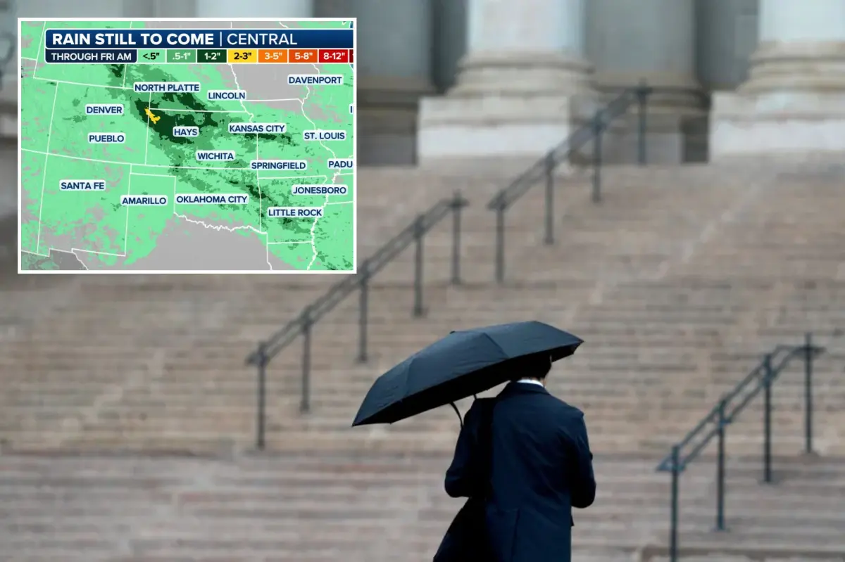
According to the FOX Forecast Center, the risk of flash flooding remains in place from the Central Plains southward to the Gulf Coast areas of Mississippi and Alabama.
“Northwesterly flow is expected to remain north of the high pressure centered over western Texas, allowing for the active pattern from the Front Range through the mid-South to remain,” the FOX Forecast Center said.
Forecasters said organized thunderstorms are expected to push south into the Southeast, the Gulf Coast and the Florida Panhandle on Wednesday.
ALSO READ: ‘Thugs in Uniform’ Chief Bought £3m Mansion Complete With Private Gym and Sauna
Because soils are already waterlogged, a Level 2 out of 4 flash flood risk now extends more than 700 miles, reaching from Nebraska to western Florida.
Cities including St. Louis and Oklahoma City remain under an active severe weather threat.

The flash flood concern is expected to continue into Thursday for parts of Kansas and Missouri, with rainfall totals by Friday potentially reaching 1 to 2 inches.
Despite the persistent wet weather, it is a welcome gift, as many cities across the Central US have experienced extreme drought.