
Share this @internewscast.com

Tropical Storm Erin developed on Monday in the eastern tropical Atlantic Ocean and may become the first hurricane of the 2025 Atlantic season later this week, according to meteorologists.
Meanwhile, Hurricane Henriette intensified in the Pacific Ocean, far from Hawaii. The National Hurricane Center in Miami reported that no coastal alerts or warnings have been issued for either storm.
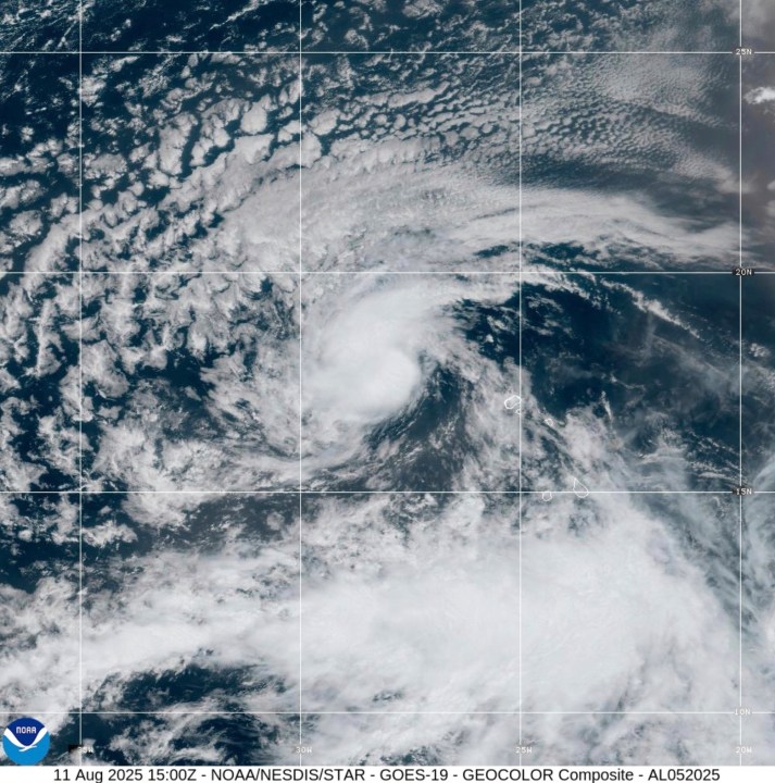
On Monday afternoon, Erin was positioned roughly 430 miles (690 kilometers) west-northwest of the Cabo Verde Islands, with top sustained winds of 45 mph (72 kph), as stated by the hurricane center. Erin was advancing westward at a speed of 20 mph (32 kph) and is anticipated to maintain this course for several days.
Forecasters predict that Erin will gradually strengthen over the upcoming days and could achieve hurricane strength by the end of the week. However, the hurricane center noted that it’s still premature to predict any potential effects from Erin as it approaches the northern Leeward Islands.
Elsewhere, Hurricane Henriette was classified as a Category 1 storm in the central Pacific on Monday, expected to maintain hurricane status for another day or two before diminishing. Henriette’s maximum sustained winds were 85 mph (140 kph), as per the NHC. The storm was situated approximately 595 miles (945 kilometers) northwest of Honolulu.
Additionally, in the Pacific, the remnants of former Tropical Storm Ivo dissipated on Monday about 615 miles (990 kilometers) west of the southern tip of Mexico’s Baja California peninsula. Meteorologists reported that the remnants of Ivo do not pose a threat to land.