
Share this @internewscast.com

On North Carolina’s Outer Banks, a well-known T-shirt from Hatteras Island humorously notes: “One road on. One road off (sometimes),” highlighting the ongoing struggle between nature and the narrow road linking the slender barrier island to the mainland.
This week, it seems Mother Nature might have the upper hand. Although Hurricane Erin is predicted to remain far offshore, it will still unleash waves exceeding 20 feet (6 meters) high, crashing over the fragile sand dunes on the islands.
Without an official hurricane warning, evacuations have been ordered for Hatteras and Ocracoke islands. The concern is that the slender highway, N.C. 12, could be severely damaged and impassable in multiple areas, potentially isolating the communities for extended periods.
The 3,500 or so Outer Bankers who live there have handled isolation before. But most of the tens of thousands of vacationers have not.
“It’s been some time since we’ve seen waves of this magnitude, and vulnerable spots have further deteriorated over the past five years,” stated Reide Corbett, head of the Coastal Studies Institute, which is part of a consortium of universities examining the Outer Banks.
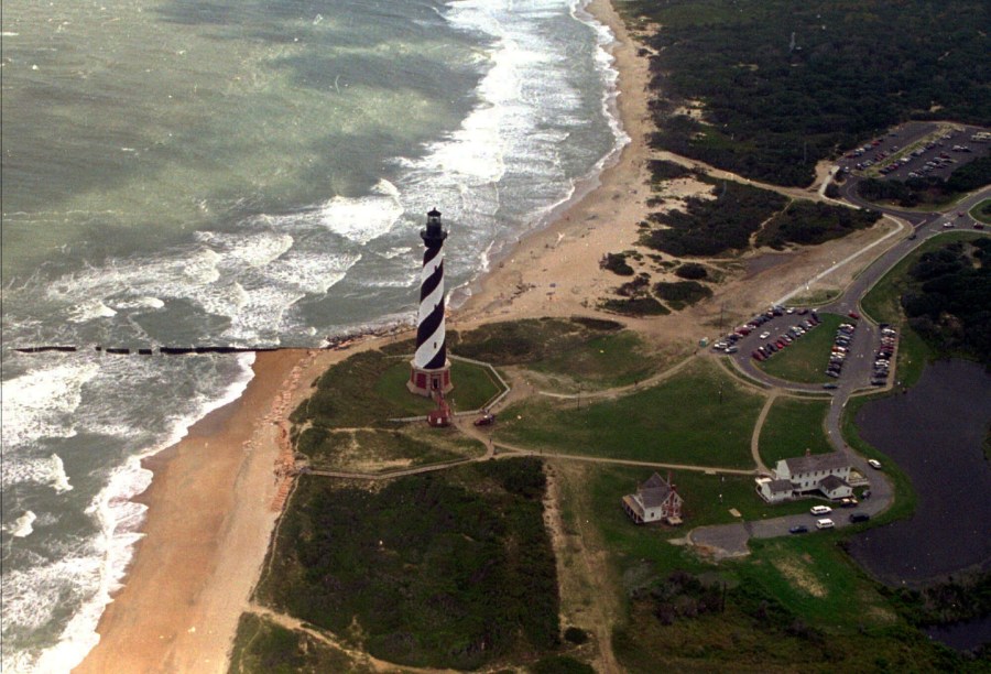
The Outer Banks are defined by water
In a basic sense, they are sand dunes that were tall enough to stay above the ocean level when many of the Earth’s glaciers melted 20,000 years ago.
These barrier islands are located up to 30 miles (48 kilometers) from North Carolina’s mainland. The wide Atlantic Ocean lies to their east, while the Pamlico Sound is to their west.
“Water, water everywhere. That really resonates on the Outer Banks,” Corbett said.
The more developed and densely populated areas around Nags Head and Kill Devil Hills, in the north, are not currently under evacuation. However, south of the Oregon Inlet, formed by an 1846 hurricane, lies Hatteras Island, which relies solely on N.C. 12 for mainland access. Further south is Ocracoke Island, reachable only by boat or air.
The first highways to reach the area were built more than 60 years ago. And the Outer Banks started booming, as it went from quaint fishing villages to what it is now, dotted with 6,000-square foot vacation homes on stilts.
Maintaining the highway is arduous
On a nice day, what look like snowplows and street sweeper brushes wait on the side of N.C. 12 to scoop and sweep away the constantly blowing sand.
When the storms come, water from the ocean or the sound punch through the sand dunes and wash tons of sand and debris on the road. In more extreme cases, storms can break up the pavement or even create new inlets that require temporary bridges.
The N.C. Department of Transportation spent more than $1 million a year on regular maintenance to keep N.C. 12 open during the 2010s. It also spent about $50 million over the decade on repairs after storms.
But the state estimates Dare County, which includes most of the Outer Banks, brings in $2 billion in tourism revenue a year. So the cycle of clean up and repair continues.
The repairs take time. Hurricane Isabel in 2003 and Hurricane Irene in 2011 both cut inlets into Hatteras Island and ferries were needed for two months. It can still take days to reopen N.C. 12 after more routine Nor’easters.
The erosion is constant
It’s not just storms that impact the island. As the planet warms and polar ice melts, rising ocean levels threaten the Outer Banks. In a place where most of the land is only a few feet above sea level, every inch of sand counts.
In Rodanthe, which sticks the farthest out into the Atlantic, the churning ocean has swallowed up more than a dozen homes since 2020. Officials think at least two unoccupied homes are likely to be lost if the waves from Erin are as strong as predicted.
The Outer Banks are still home
Shelli Miller Gates waited tables on the Outer Banks to earn money as a college student in the late 1970s. She remembers houses with no air conditioning, televisions or phones. And she adored it.
“I love the water. I love the wildness of it. It’s the way I want to live my life,” the respiratory therapist said.
It’s a lifestyle embraced by many. The area’s shorthand “OBX” shows up in many places as a source of pride, including the first three letters on license plates issued by the state.
The isolation contributes to a sense of community. Gates has seen people band together countless times when their connection to the outside world is severed. And there is always the allure of getting to live someplace where others just get to visit.
“There’s things everywhere. There’s earthquakes and lizards and floods. Looks at the poor people out in western North Carolina,” Gates said. “There are so many things that can happen to you. I feel like you have to find the place that feels like home.”
___
Associated Press journalist Ben Finley contributed to this report.