Share this @internewscast.com
Hurricane Erin intensified dramatically to a Category 5 storm in the Caribbean on Saturday, escalating from a tropical storm within just one day, according to the National Hurricane Center.
While the compact hurricane’s center wasn’t expected to hit land, it threatened to dump flooding rains as it continued to grow larger.
Erin marks the first Atlantic hurricane of 2025, elevating from a tropical storm to a Category 5 hurricane in only 24 hours. By late Saturday morning, its maximum sustained winds surged to 160 mph.
Located 105 miles north of Anguilla around 11 a.m. Saturday, Erin moved west at 17 mph. Forecasts indicated that its center would stay at sea, bypassing Puerto Rico and the Virgin Islands to the north without making landfall.
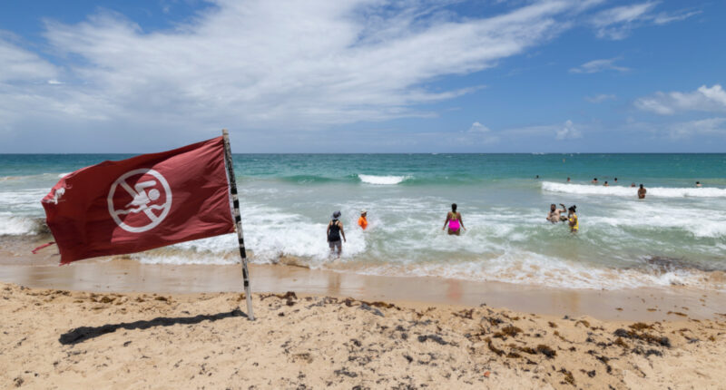
Despite its path, Erin was near enough to impact nearby islands. Tropical storm watches were issued for St. Martin, St. Barts, and St. Maarten, with warnings from the Hurricane Center about potential flash flooding, landslides, and mudslides from heavy rains.
Tropical-storm force wind gusts are possible in the Turks and Caicos Islands and southeast Bahamas.
Though it was compact, with hurricane-force winds spanning 30 miles from its center, the Hurricane Center anticipated Erin would double or even triple in size in the upcoming days. This could mean significant rip currents off portions of the U.S. East Coast later in the week, despite the storm’s eye staying far offshore.
Areas of the U.S. coast like North Carolina’s Outer Banks, Long Island, New York, and Cape Cod, Massachusetts, are at a heightened risk of experiencing direct and possibly severe tropical storm or hurricane conditions compared to other parts of the southern Atlantic, mid-Atlantic, and northern New England coasts, according to AccuWeather.
Scientists have linked rapid intensification of hurricanes in the Atlantic Ocean to climate change. Global warming is causing the atmosphere to hold more water vapor and is spiking ocean temperatures. The warmer waters give hurricanes fuel to unleash more rain and strengthen more quickly.
Storms that ramp up so quickly complicate forecasting for meteorologists and make it harder for government agencies to plan for emergencies. Hurricane Erick, a Pacific storm that made landfall June 19 in Oaxaca, Mexico, also strengthened rapidly, doubling in intensity in less than a day.
Erin is the fifth named storm of the Atlantic hurricane season, which runs from June 1 to Nov. 30. It’s the first to become a hurricane.
The 2025 hurricane season is expected to be unusually busy. The forecast calls for six to 10 hurricanes, with three to five reaching major status with winds of more than 110 mph.
The U.S. government has deployed more than 200 employees from the Federal Emergency Management Agency and other agencies to Puerto Rico as a precaution as forecasters issued a flood watch for the entire U.S. territory from late Friday into Monday.
Puerto Rico Housing Secretary Ciary Pérez Peña said 367 shelters have been inspected and could be opened if needed.
The U.S. Coast Guard said Friday that it closed six seaports in Puerto Rico and two in the U.S. Virgin Islands to all incoming vessels unless they had received prior authorization.
Meanwhile, officials in the Bahamas said they prepared some public shelters as a precaution as they urged people to track the hurricane.
“These storms are very volatile and can make sudden shifts in movement,” said Aarone Sargent, managing director for the Bahamas’ disaster risk management authority.
Associated Press reporter Isabella O’Malley contributed from Philadelphia.
Copyright © 2025 by The Associated Press. All Rights Reserved.


