
Share this @internewscast.com
On Sunday, Hurricane Erin reduced to a Category 3 storm, yet its outer bands continued to batter the Virgin Islands and Puerto Rico with intense rain and winds typical of a tropical storm.
Despite the decrease in Erin’s peak winds, its overall size expanded, prompting forecasters to issue tropical storm warnings for the Turks and Caicos Islands and a watch for the southeastern Bahamas.
Though the storm was not anticipated to directly affect the U.S. East Coast, its growth could lead to rip currents along the Southeast coast. According to the National Weather Service, strong winds and high tides might erode portions of the highway linking the North Carolina Outer Banks by the middle of the week.
Bermuda could have similar conditions as Erin is forecast to turn to the north and then northeast, forecasters said.
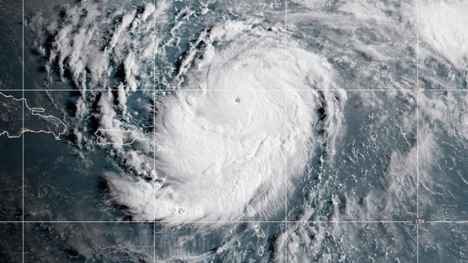
Erin, the first Atlantic hurricane of 2025, reached Category 5 status Saturday with maximum winds of 160 mph (260 kph) before weakening.
The storm’s maximum sustained winds were 125 mph (205 kph) late Sunday morning, according to the National Hurricane Center in Miami.
The winds decreased as the storm went through internal changes. Erin is expected to remain powerful for the next several days, forecasters said.
“This is a major hurricane you’re contending with. The intensity varies, making it a hazardous hurricane in any scenario,” stated Richard Pasch from the National Hurricane Center.
The center of Erin was approximately 200 miles (320 kilometers) north-northwest of San Juan, Puerto Rico, and 240 miles (385 kilometers) east of Grand Turk Island, progressing west-northwest at 13 mph (20 kph).
The storm’s outer bands’ rain and wind left around 147,000 customers in Puerto Rico without power on Sunday morning, as reported by Luma Energy, the private company managing power transmission and distribution on the island. Officials noted more than 20 flight cancellations due to the weather.
Swells were also expected to affect portions of the Virgin Islands, Puerto Rico, Hispaniola and the Turks and Caicos Islands during the next couple of days, forecasters said.
A tropical storm warning means tropical storm conditions are expected somewhere within the warning area, and in this case, within 24 hours, the hurricane center said. Heavy rain is still expected across the Virgin Islands and Puerto Rico, with rainfall of 3 to 6 inches (about 7.6 to 15 centimeters), with 8 inches (20 centimeters) in some isolated areas.
The government of the Bahamas also issued a tropical storm watch for the Southeast Bahamas.
Scientists have linked the rapid intensification of hurricanes in the Atlantic to climate change. Global warming is causing the atmosphere to hold more water vapor and is spiking ocean temperatures, and warmer waters give hurricanes fuel to unleash more rain and strengthen more quickly.
Copyright © 2025 by The Associated Press. All Rights Reserved.