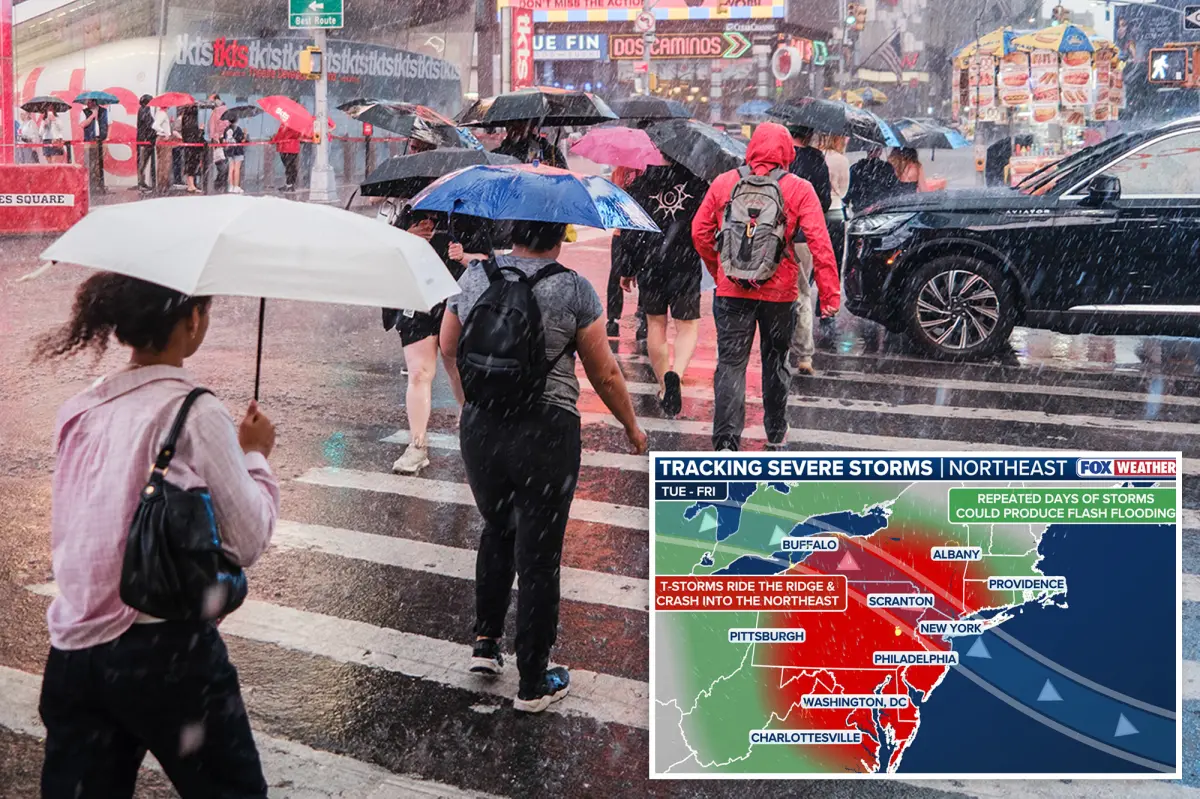

A volatile weather pattern is setting up as multiple disturbances slide along the northern rim of a heat dome parked over the Central Mississippi Valley, bringing a stormy stretch to the Northeast, Mid-Atlantic and Great Lakes. The setup is expected to raise the risk of severe thunderstorms that could produce damaging wind gusts, large hail and possibly an isolated tornado or two.
Forecasters warn that the strongest storms may be powerful enough to knock down trees and power lines. The threat of flash flooding is also expected to grow, particularly in cities and heavily paved areas where heavy rain can quickly overwhelm drainage systems.
At this point, parts of the region are facing four straight days with at least a Level 2 out of 5 risk for severe weather.
For places such as Philadelphia, this may mark the first time since 2023 that a Level 2 out of 5 severe storm threat has been in place for three consecutive September days.
According to the FOX Forecast Center, the 2023 episode was one of only a few comparable stretches, with another noted in 2008, making this extended run of severe weather risk unusual for some communities.
The multiday severe weather threat is expected to begin Tuesday and continue through Friday.
Tuesday
The first round is forecast to develop Tuesday afternoon, when a weak disturbance tracks across New York, New Jersey and Connecticut before pushing into southern New England.
As the day progresses, atmospheric energy is expected to build sharply, creating an environment favorable for more organized thunderstorms capable of producing damaging winds, severe hail and perhaps a couple of tornadoes.
A second, more pronounced disturbance will dive around the top of the heat dome late Tuesday night, with storms originating around the Great Lakes during the day expected to merge into a storm complex that tracks southeast toward the Mid-Atlantic coast.
As this complex sweeps through, damaging wind gusts and hail will remain the primary hazards, particularly across central and southern Pennsylvania into Wednesday morning.
Wednesday
According to the FOX Forecast Center, scattered thunderstorms may already be underway across Pennsylvania and points southeast early Wednesday.
As clouds and morning storms begin to break up, enough heating should develop through the afternoon to create a warm, humid, and increasingly unstable atmosphere, and with a more potent upper-level disturbance moving across the region, it will provide the support needed for storms to re-organize.
The main threats will be damaging wind gusts and large hail, although a couple of tornadoes will also be possible in the strongest storms.
“This will likely be the day with the most damaging wind reports and potential loss of power,” the FOX Forecast Center said.
Additionally, a Level 2 out of 4 flash flood threat has been issued for Wednesday, which includes New York City.
Thursday and Friday
On Thursday, the heat dome to the south will continue to strengthen and shift back west, while more dips in the jet stream will deepen along the East Coast, creating a more favorable pattern for severe thunderstorms across the Mid-Atlantic and eventually the Carolinas.
In addition, numerous record high temperatures will be possible in the exact areas expecting storms.
Thursday’s severe threats shift slightly farther south in the Mid-Atlantic, encompassing Washington, D.C. Storms may develop near the Delmarva or areas farther west along boundaries left behind by earlier storms.
“All the ingredients from the previous two days will come back into play as we head into Labor Day Weekend,” the FOX Forecast Center noted.
Come Friday, another round of severe storms is likely as the dip in the jet stream strengthens further across the East Coast. The focus may shift into the southern Mid-Atlantic states, where damaging wind gusts would be the primary concern yet again.
By Saturday, some severe potential could linger farther south across the Carolinas before the pattern breaks down.