
Share this @internewscast.com

On Saturday morning, Tropical Storm Chantal emerged near the coast of South Carolina, leading to Tropical Storm Warnings being issued for parts of the state’s coastal areas and suggesting that the holiday weekend would end on a stormy note.
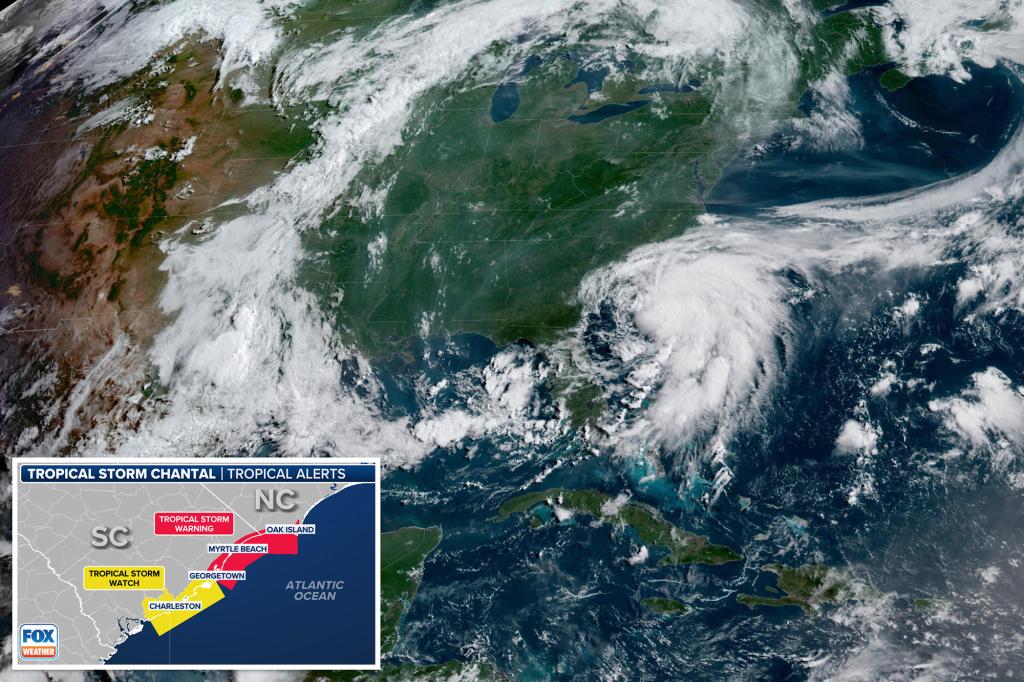
With maximum winds reaching up to 40 mph, Chantal is situated approximately 150 miles southeast of Charleston, South Carolina, moving northward slowly at about 2 mph, as reported by the National Hurricane Center.
The storm is anticipated to gain slightly more strength throughout Saturday, with a predicted landfall expected on the northern coast of South Carolina by Sunday morning.
“The number one impact by far will be the locally heavy rain, especially along and where the center comes on shore north of (Folly Beach) sometime late tonight, but more than likely, sometime Sunday morning, maybe before sunrise, maybe just after sunrise,” FOX Weather Storm Specialist Mike Seidel said from Folly Beach. “It’s a broad center at this point.”
Tropical Storm Warnings are in effect from South Santee River, South Carolina to Cape Fear, North Carolina. A Tropical Storm Watch is in effect from Edisto Beach to South Santee River, South Carolina.
Tropical storm-force winds are expected in the warning areas starting Saturday evening and lasting into Sunday morning. Gusts to 40-45 mph are possible in the watch areas later Saturday.
“With that said, if you get a gust 40 to 45 (mph), it probably is not going to cause any structural damage, likely not to knock out any power, a little if any power,” Seidel said. “Once again, re-emphasizing the rain and then on these beaches, you’ll have the wave action and certainly the rip currents, especially on the South Carolina coast up towards, say, Wrightsville.”
In addition, heavy rains are across the coastal plains of the Carolinas into Monday, with widespread areas receiving 2-4 inches. Some isolated spots could get up to 6 inches of rain, the NHC says.
Chantal will even bring a minor storm surge to parts of the Carolina coasts.
“The combination of storm surge and tide will cause normally dry areas near the coast to be flooded by rising waters moving inland from the shoreline,” the NHC said.
Peak surge could reach about 1-3 feet in the Tropical Storm Warning area, and about 1-2 feet in the watch area.
Heavy surf and life-threatening rip currents will be an added danger for those along the beaches in Chantal’s path.
The Atlantic hurricane season runs from June 1 to Nov. 30.